Subscribe now for full access and no adverts
The very hot and dry conditions associated with this summer’s heatwave have produced a diverse array of cropmarks and parchmarks testifying to the presence of underlying archaeology, ranging from prehistoric burial monuments to First World War practice trenches. While some of these are already well-known sites, the particularly clear, sharp outlines that have emerged this year can be easily captured in aerial photographs, creating detailed records of their remains. In other locations, though, hints of previously unknown archaeological sites have come to light for the first time.
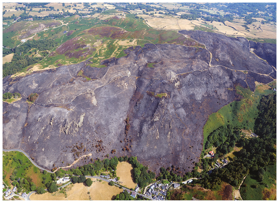
The work of documenting these finds was not always straightforward: our aerial reconnaissance programme – beginning during late June and continuing through the heatwave into August – was intense at times, as we battled pilot availability, turbulent winds, and low cloud over the hills to keep up with the increasingly dry conditions on the ground. A series of wildfires across the country posed further challenges, with smoke obscuring the air in certain survey areas: in one photo accompanying this article you can see the aftermath of the July wildfire at Sychnant near Conwy, which affected around 200 acres (81ha) of land.
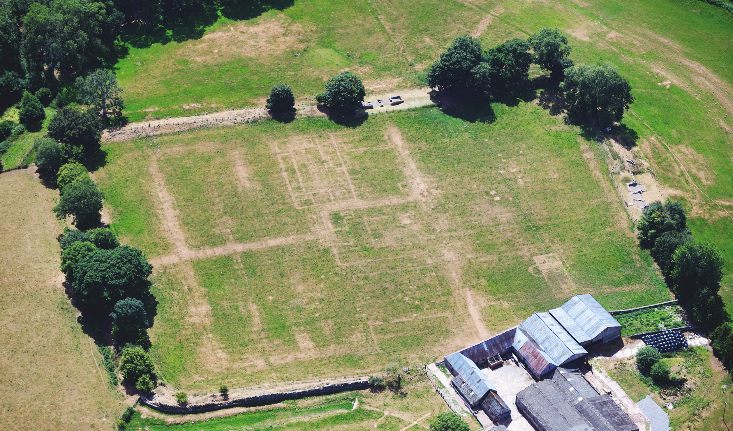
As the season progressed, after the traditional cropmarks that appear in ripening fields of wheat and barley – which had been harvested in early to mid-July – it was the widespread parching of monuments under grassland that dominated the survey work. Any site with buried stonework, particularly Roman forts and medieval castles, appeared like exceptionally clear X-rays below the aircraft – for example, at Caerhun Roman fort in north Wales. Known to the Romans as Canovium, this auxiliary fort was founded c.AD 75 during Gnaeus Julius Agricola’s invasion of Wales. It was positioned to guard an important crossing of the River Conwy, and formed part of a chain of fortifications stretching from Deva Victrix (Chester) to Segontium (Caernarfon). Originally a timber fort, it was rebuilt in stone around AD 120 and was occupied periodically until the 4th century. Today, the fort’s north-eastern corner is obscured by St Mary’s Church (Eglwys y Santes Fair; the current church dates to the 13th century) and its walled churchyard, but the wider site was excavated in 1926-1929 by P K Baillie Reynolds, establishing a detailed plan of its layout. A century after these investigations, the remains of Canovium’s defences and the buildings that lay within them are buried beneath farmland – but, as this summer’s aerial surveys have demonstrated, their outlines become visible once more during dry conditions. During our flight in July, several new sections of the Roman vicus (civilian settlement) and riverside infrastructure were revealed.
Another Roman site that produced particularly clear images is Y Gaer fort, near Brecon in central Wales. Excavated by Mortimer Wheeler in the 1920s, Cicucium was a large auxiliary fort – in fact, one of Rome’s largest inland forts – which was garrisoned by the ala Hispanorum Vettonum, a cavalry unit originally raised in lands that today lie within Spain and Portugal. It was strategically located at the meeting point of two major Roman roads in the Usk river valley, and formed part of a chain of similar fortifications. Like Canovium it was founded around AD 75 and was initially constructed using wood, before being rebuilt in stone in the 2nd century. Today preserved beneath farmland, its remains could be easily seen during this summer’s surveys, including new details of the road network that connected the fort to the wider countryside.

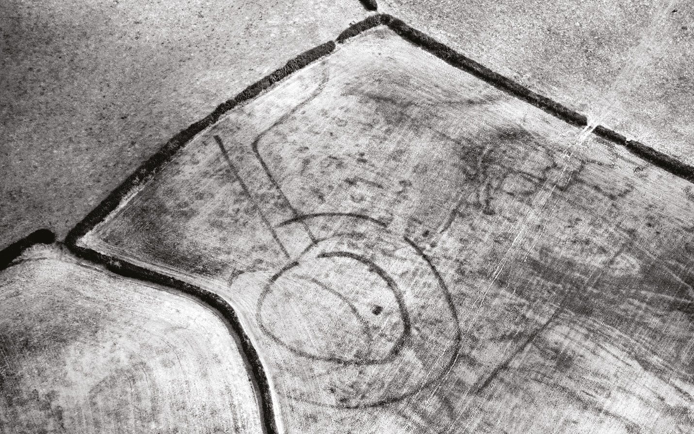
This summer’s parchmarks revealed the presence of previously unknown features, too. Some of these emerged as we moved into late July and early August, when farmers were cropping fields of grass for silage, leaving vast areas of stubble. These then began to produce regrowth cropmarks – quite a rare phenomenon, which only happens in the driest summers – and one of the photos in this article highlights how clear these marks can be. To the east of Haverfordwest in Pembrokeshire, we documented a newly discovered Iron Age farmstead: its markings represent a two-phase concentric farmstead with a long trackway approaching its entrance. Several similar discoveries across west Wales raise new questions about the density of settlement in pre-Roman Wales and the relative sophistication of the farming communities who built these great structures. Once rain starts to fall and fresh grass grows, these marks will rapidly disappear, rendering the sites entirely invisible until the next summer with drought conditions.
Images: © Crown copyright: RCAHMW