
Subscribe now for full access and no adverts
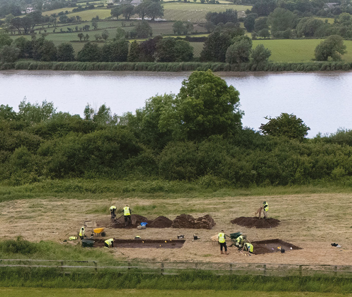
As the ancient Greek philosopher Heraclitus said (and Disney’s Pocahontas sang 2,500 years later), ‘you can’t step in the same river twice’. Just as flowing water constantly renews itself, though, the courses of rivers also change and shift over time, shaping landscapes and the lives of the people who live within them. The River Trent is a case in point. Today, it is one of the longest rivers in the United Kingdom, flowing from its source on Staffordshire’s Biddulph Moor to the Humber Estuary, where it joins the River Ouse and enters the North Sea. Its current appearance as a single watercourse is only a relatively recent development, however, which emerged after the end of the last Ice Age. Prior to that, its story enters murkier waters, with competing hypotheses proposing different forms, but LiDAR images have proven an invaluable addition to aerial photos in picking out long-vanished river channels and helping to interpret the Trent’s more recent incarnations.
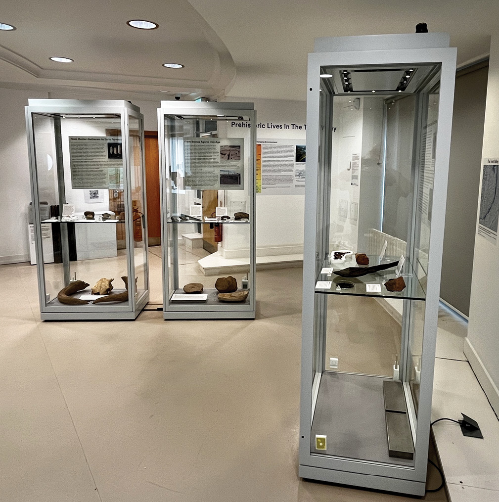
During the early Mesolithic period, around 10,000 BC, the Trent Valley is thought to have been home to extensive wetlands threaded with dense mixed woodland. Then, over subsequent centuries, the course of these waterways changed and consolidated, while increasingly intense human occupation within the valley transformed the surrounding landscape through tree-clearance, agriculture, and construction. A wide-ranging exhibition currently running at the University of Nottingham Museum (see ‘Further information’ below) traces this long story of interaction and evolution, combining excavated environmental evidence and artefacts reflecting the successive communities who called the Trent Valley home through prehistory.

Wild woods and winding waters
Prehistoric Lives in the Trent Valley begins long before the Mesolithic landscape described above (more reminiscent of northern Canada than the modern Midlands, the exhibition’s curators note) came into being. The earliest evidence for a human presence in the Trent Valley dates to around 300,000 BC, in the form of stone handaxes created by nomadic groups of hunter-gatherers who came in search of prey and useful resources. Other than stone implements, they did not leave much of a mark on the landscape that they moved through. These handaxes are generally not found where they had originally been dropped or deposited: their heavily worn appearance speaks of them travelling long distances, borne by glacial meltwater. Many examples have been recovered during modern gravel-extraction works, and quarrying companies have made a key contribution to our understanding of the area’s archaeology, not only uncovering long-buried finds but also funding numerous developer-led excavations. Most of the objects in the exhibition stem from investigations by York Archaeology over the last 30 years.

The first evidence of remains found in situ in the region dates to the Upper Palaeolithic period, around 40,000-10,000 BC. Sites like Farndon Fields, near Newark in Nottinghamshire, have produced concentrations of flint scrapers, speaking of groups returning to the same gravel terrace to process animal hides on multiple occasions. These people presumably created open-air encampments that have otherwise left little trace, but echoes of the activities that they carried out still endure.
Mesolithic hunter-gatherers trod similarly lightly in their environment, but with the advent of agriculture and more permanent settlements around 6,000 years ago, during the Neolithic period, humans began to have a more dramatic and lasting impact on their surroundings. Environmental evidence testifies to gradual but extensive tree-clearance within the Trent Valley at this time, making deep inroads into what was once dense woodland. As the land became more open and exposed, improving visibility and people’s ability to move through the valley, these changes may also have prompted a growing sense of ownership, motivating communities to build the diverse funerary and ceremonial monuments that appear during this period. Particularly enigmatic are the cursus monuments that have been identified in the surrounding area, such as those at Aston-on-Trent (see CA 167) and Potlock (CA 157). The purpose of these arrangements of long, parallel ditches has long been lost to history, but their scale highlights not only the labour and resources that could be marshalled in their construction, but also the transformative effect that these efforts would have had over large areas of the landscape.

Some tree-clearance was driven by the agricultural activities that helped to sustain larger and more-enduring settlements. Neolithic farmers did not only raise crops: animal domestication and livestock rearing would have had a significant impact on the natural world. In the exhibition, the horns of an aurochs (a huge, now-extinct species of prehistoric cattle; the example on display was excavated at Langford Quarry, Nottinghamshire, and has been radiocarbon dated to c.6000 BC) are shown alongside the skull of a modern cow, dwarfing the latter and exemplifying the shift from wild to domesticated animals within the Trent Valley.
Divide and conquer
During the Bronze Age, a further intensification of settlement brought more people, more movement, and more monuments to the valley. The local archaeological record is peppered with the remains of roundhouse settlements and ring ditches that once surrounded burial mounds. These barrows often contained cremated remains held within distinctive forms of pottery, such as decorated Collared Urns and Food Vessels. A partial example of the latter, from Barrow-upon-Trent in Derbyshire, is included in the exhibition. It once held the remains of a 10- to 15-year-old child, and its truncated form, sliced in two by a medieval plough, speaks of the lucky survival of fragile evidence. It also reflects how farming in the valley has been a constant spanning thousands of years – as well as a recurring issue within the area’s archaeology, as deep medieval furrows are often found to have damaged earlier remains.

It was not only the landscape that was changing during the Bronze Age, however. Archaeological remains point to social and economic changes, too, highlighting in particular the revolutionary impact of the introduction of metalworking. The Trent Valley has produced an extensive array of Bronze Age metalwork – one of the largest assemblages in Europe – uncovered through dredging, gravel extraction, and archaeological investigations. Much of this appears to have been deliberately placed within the liminal watery spaces of the river and its surrounding wetlands (CA 418), and the c.200 bronzes recovered from along the course of the Trent include both tools and weapons. Might the fact that this new technology had been used not just to craft useful implements, but also items specifically designed to signal status or enact violence (such as the spearhead within the displays, which has traces of its wooden shaft still preserved within its socket), speak of increasing competition for land and resources sparking conflict between neighbouring communities?
The appearance of extensive field systems may also reflect a more formalised division of land-ownership – yet, while more and more people seem to have been putting down roots within the Trent Valley, the river remained a key corridor for movement. Goods including salt, quern stones, and pottery were being transported into the region at this time, and water would have been a convenient way to convey these in any quantity. Occasional discoveries of Bronze Age and Iron Age logboats, found buried in river gravels during modern quarrying works, could reflect some of these journeys. One example was uncovered at Aston-on-Trent in Derbyshire, complete and still containing its cargo of sandstone blocks. This material has been traced to a source about 3km (1.9 miles) upstream, and the craft appears to have capsized while transporting the blocks to their intended destination, highlighting the dangers inherent in undertaking such journeys, and the skill of those able to navigate the waters of the Trent basin. In the exhibition, discussions of logboats are complemented by evidence of other journeys on dry land, including a D-shaped copper-alloy terret (rein guide) from a horse-drawn cart or chariot.
Far-reaching and often complex trade networks represent an enduring aspect of the Trent Valley’s story. Just as Neolithic finds from the region testify to stone tools travelling from as far afield as Great Langdale in the Lake District, this theme of mobility and interconnectedness continues into the Iron Age, when pottery (or perhaps its raw materials) was brought from the Peak District and Charnwood Forest in Leicestershire, and recovered examples reflect diverse regional traditions.
A flow of finds
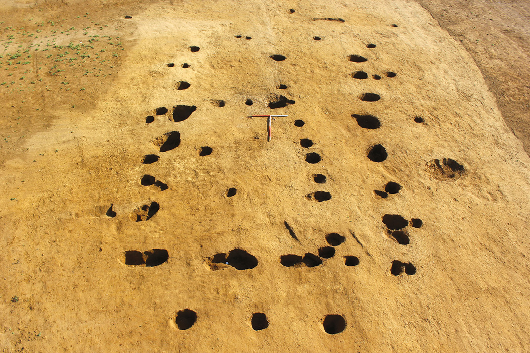
Concentrations of pits, post-holes, and boundary ditches speak of human occupation becoming ever denser over the course of the 1st millennium BC, providing the footprints of structures and the outlines of field systems belonging to closely spaced settlements. Among the sites highlighted in the displays is Hoveringham in Nottinghamshire, a multi-phase roundhouse settlement on a low gravel ridge above the Trent floodplain where regular arrangements of Iron Age ditches (and, in one place, a surviving bank preserved beneath alluvium) demarcate rectangular fields.
One of the site’s ditches produced a particularly rare find: a well-preserved oak shovel, which is included in the displays. It is tempting to imagine that the tool could have been used to dig this feature before it was discarded or deposited within it – and its presence reminds us that the river has not only shaped the ways in which humans have interacted with the Trent Valley: it has also made a key contribution to our ability to tell these stories today. This waterlogged landscape is a rich source of environmental evidence like pollen, insects, and charred plant remains that help us reconstruct how the area’s appearance has changed over millennia, and these conditions also preserve organic artefacts that often do not survive elsewhere. Another find from Hoveringham that is on show at the University of Nottingham Museum is a piece of woven woollen textile, which had survived for centuries at the bottom of a large infilled pond dating to the late Iron Age or early Roman period.
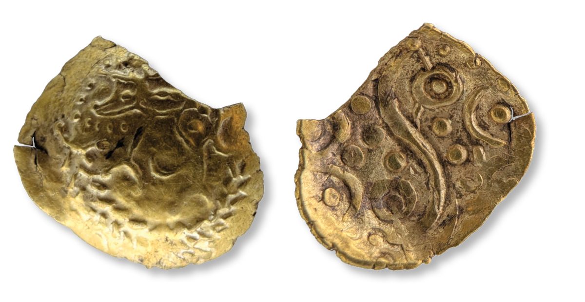
The exhibition concludes on the cusp of the Roman conquest. When imperial forces entered the Trent Valley, they would have encountered a place that was worlds away from the thawing environment known to early hunter-gatherers 10,000 years earlier. The wild woodlands had been swept away, transformed into a well-ordered landscape devoted to growing crops and grazing livestock, scattered with well-established settlements. The appearance of coins in the late 1st century BC speaks of new forms of political organisation towards the end of the Iron Age, too. The earliest issues copy Continental designs, but local innovations soon flourished: the gold and silver examples on display, bearing images of stylised boars and horses, testify that generations before Roman troops arrived in the Trent Valley, these lands lay within the territory of the Corieltauvi people.
While activities, occupation patterns, and identities have ebbed and flowed beside the Trent throughout prehistory, and while the river itself has changed shape and course many times, its waters have remained as a constant presence: a shining ribbon linking diverse communities over the span of millennia.
• Prehistoric Lives in the Trent Valley will be at the University of Nottingham Museum until 10 January 2027. The museum is open noon 4pm Thur-Sun; entry is free.
• For more details, see http://www.lakesidearts.org.uk/exhibition/prehistoric-lives-in-the-trent-valley.
Source:
• Dr David Knight is Head of Research at York Archaeology and one of the curators of Prehistoric Lives in the Trent Valley along with his colleagues Kristina Krawiec (Head of Geoarchaeology) and Dr Steve Malone (Senior Researcher).
• Dr Clare Pickersgill is Keeper of the University of Nottingham Museum.