Subscribe now for full access and no adverts
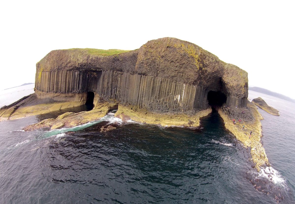
For generations, Staffa has been known as an island of natural wonders. Rising dramatically from the Atlantic, west of Mull, its black basalt columns and the soaring cathedral of Fingal’s Cave have inspired travellers, artists, musicians, and scientists since the intrepid naturalist Joseph Banks first brought the island to wider public attention in 1772. Wordsworth marvelled at it, Mendelssohn transformed its atmosphere into music, Turner painted it, and Queen Victoria made the journey to see it for herself.
Yet, for all its fame, Staffa’s human story has remained surprisingly little known. Visitors (today, around 80,000-90,000 a year) tend to view it as an island shaped by geology rather than people, a place of puffins, sea caves, and volcanic rock. Recent archaeological investigations have revealed a rather different picture, however. Beneath the turf, around the ruins in the island’s centre, and even beneath the structures built for Victorian tourists, survives evidence of a landscape that has been occupied, farmed, visited, and experienced for thousands of years.
The opportunity to tell this story is particularly timely. The completion of recent work to improve Staffa’s landing facilities and visitor access has prompted renewed examination of the archaeological evidence for earlier jetties and stairways, while 2026 marks 40 years since the National Trust for Scotland took the island into its care. Over the last decade, collaborative research undertaken by the National Trust for Scotland, the Universities of Glasgow and Stirling, and the Glasgow School of Art has transformed our understanding of one of Scotland’s best-known islands. What has emerged is a story stretching from Second World War naval activity and Victorian tourists to the Bronze Age communities who called the island home nearly 4,000 years ago.

Reaching the island
The first challenge for anyone visiting Staffa has always been landing on it. Today, visitors arrive via a modern jetty and a substantial stairway, climbing from Clamshell Cave on to the island plateau. These facilities represent only the latest chapter in a long history of attempts to tame an exposed Atlantic shoreline that offers no natural harbour, often involving surrounding island communities.
When the first wave of tourists began arriving after Banks’ visit in 1772, there were no formal landing facilities. Visitors were often put ashore directly on to the rocks from small boats, and contemporary accounts describe travellers scrambling along slippery foreshore ledges or climbing steep slopes to reach the island interior. Early illustrations even show boats landing passengers at the entrance to Fingal’s Cave itself.
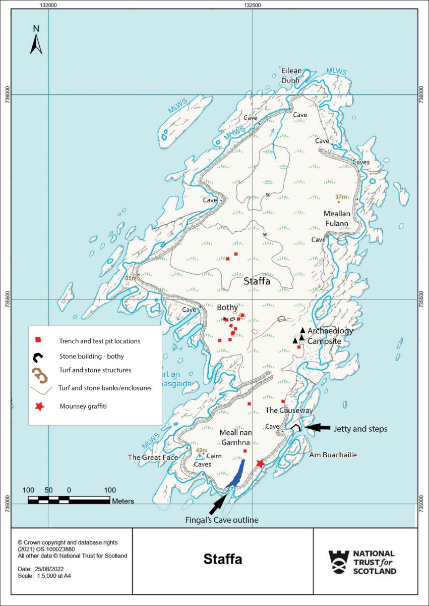
As visitor numbers increased throughout the 19th century, though, improvements followed. By the 1830s, a timber stairway had been built beside Clamshell Cave, allowing access up the cliff and along the coast, via a natural feature, the ‘Causeway’, to Fingal’s Cave. Historic photographs suggest that this was replaced around 1885 by a much larger double-width wooden staircase, complete with handrails and life rings. Visitors could ascend on one side and descend on the other, reflecting Staffa’s growing popularity as an organised tourist destination.
The 20th century brought further modifications, some of which feature in the social memory and oral histories of surrounding island communities closely connected to Staffa. The wooden stairs were removed in the 1930s and replaced with narrower concrete works, while sections of the famous Causeway were altered to improve access. New stairs followed in 1977, and a concrete-and-steel jetty was completed in 1991 following the National Trust for Scotland’s acquisition of the island.
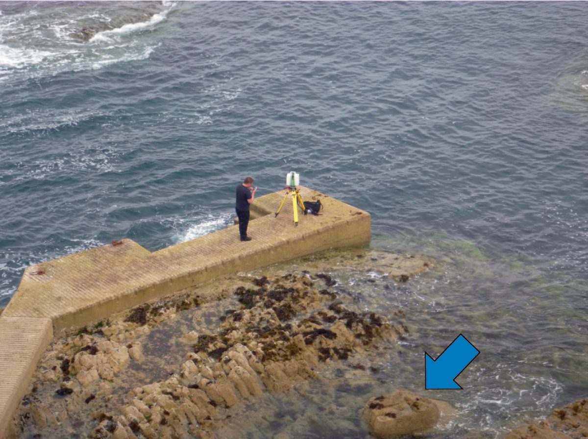
Archaeological survey undertaken in advance of the most recent jetty improvements, which only opened earlier this year, identified surviving traces of several of these earlier schemes. Concrete foundations, rusting steelwork, walkway supports, and landing-stage remains survive around Clamshell Cave, preserving a remarkable sequence of visitor infrastructure spanning almost two centuries. Although individually modest, these remains represent the physical archaeology and valued everyday heritage of tourism itself.
Recording a global icon
The emblematic heart of Staffa remains Fingal’s Cave, one of the most recognisable natural features in Europe. In 2014, the cave became the focus of an ambitious programme of digital recording. Laser-scanning captured the entire southern end of the island, together with the cave interior, producing an exceptionally detailed three-dimensional model of the basalt columns and the great sea cavern itself. Acoustic specialists simultaneously undertook a series of sound sweeps, allowing the cave’s remarkable acoustic properties to be modelled and visualised for the first time.
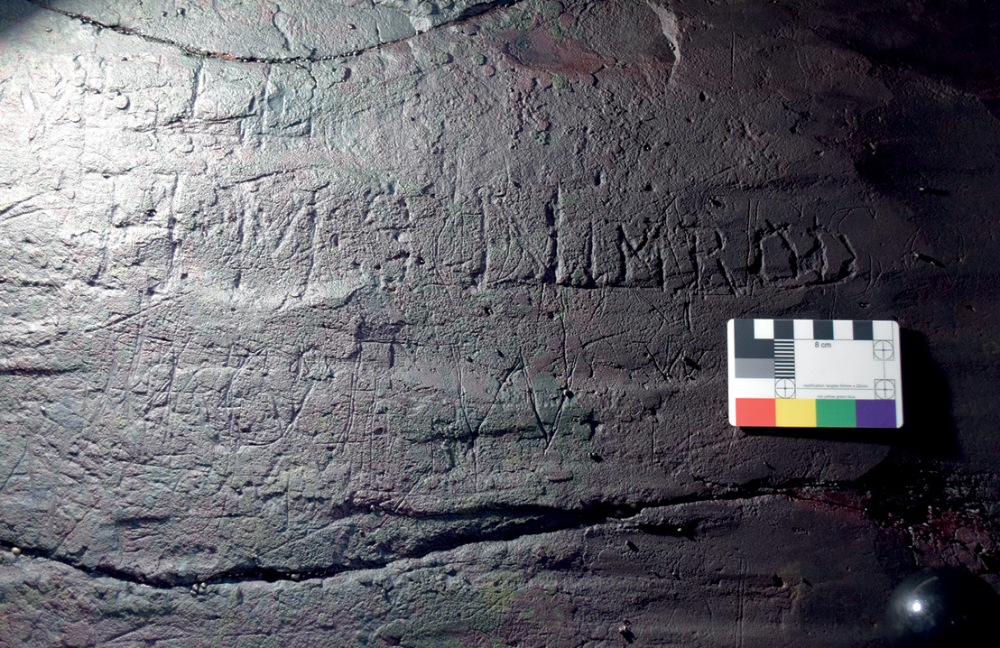
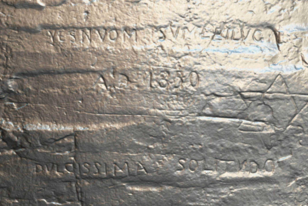
The work revealed far more than dramatic geology. Among the features recorded were numerous historical graffiti inscriptions carved into the cave walls and along the approach. These names, initials, dates, and commemorative marks were left by generations of visitors who wished to preserve a memory of reaching one of Europe’s most celebrated destinations. Today, such carvings might be considered vandalism, but these examples represent significant historical records, as they include mentions of multiple naval vessels spanning the 19th century to the Second World War, and naming vessels from the Royal Navy, the Royal Netherlands Navy, the German Navy, and more. Some of their names – HMS Quentin Roosevelt, HMS Alecto, HMS Nimrod – conjure fascinating stories in their own right, speaking of various famous naval missions, though – perhaps strangely – so far there is no trace of the mine-sweeping trawler HMS Staffa. The graffiti includes some identifiable individuals and groups, and a little outside Fingal’s Cave itself we find a previously unknown example of the work of the notorious Victorian adventurer William Mounsey. Famous for the cryptic ‘Persian’ graffiti that he left on the Neolithic Dwarfie Stane, a rock-cut tomb on Hoy in Orkney, on Staffa Mounsey favoured a Latin motto (dvlcissima solitvdo [sic], probably to mean ‘sweetest solitude’) and a Star of David. Although not Jewish, his interest in mysticism and symbolism led him to be known as the ‘Jew of Carlisle’. On the Dwarfie Stane and Staffa alike, he signed his inscription with the same enigmatic, Latinised, and reversed version of his name, ‘Yesnvom Svmleilug’. Both places were apparently inscribed in the same year, 1850.
These graffiti provide evidence for individual journeys, but also networks of relationships both military and civilian, illuminating the strength of connection felt by visitors during the great age of Romantic tourism and later. While each inscription points to a personal encounter with Staffa’s extraordinary landscape, taken together they signal the urge of many to write themselves permanently into the story of the island and the wonders it represents.
The bothy in the middle of nowhere
At the centre of the island stands the remains of a roofless stone building known simply as the Bothy. Unlike the rough remains of earlier agricultural structures seen nearby, the Bothy was designed specifically for visitors. Historical sources suggest that it was built in the early 19th century, probably by Ranald MacDonald of Boisdale, as tourism to Staffa was beginning to flourish. Gothic-style windows and a more formal architectural appearance distinguished it from ordinary Hebridean farm buildings, and excavation inside the structure in 2017 revealed evidence for its construction and later use. Archaeologists uncovered deposits containing fragments of teacups, plates, storage jars, whisky bottles, window glass, animal bone, and other domestic debris, all representing traces of the Bothy’s long-term use as a shelter and picnic spot by generations of tourists.
The building itself appears to have been erected directly on the existing ground surface, with little evidence for formal foundations. Interestingly, the 2017 investigation suggested that its stones had been quarried locally and that its masonry may have been robbed partly from earlier ruined buildings nearby. Beneath the 19th-century layers, however, we encountered something wholly unexpected.
Before the tourists
Long before visitors arrived to admire Fingal’s Cave, Staffa supported a small farming community. Survey work undertaken as part of the Staffa Archaeological Research Project identified at least three earlier buildings surrounding the Bothy, together with enclosures, field boundaries, quarry scoops, and extensive areas of rig-and- furrow cultivation. Much of the central plateau appears to have formed a carefully managed agricultural landscape.
The first direct evidence for this landscape came in 2014. Excavation of a test pit within a D-shaped kailyard (vegetable patch) enclosure revealed a charcoal-rich burnt deposit, and environmental analysis identified carbonised oats, heather charcoal, seaweed fragments, and shellfish remains. This suggests that the burnt deposit was part of a domestic hearth where oats were processed or prepared using heather as fuel, perhaps supplemented by seaweed gathered from the shore. Radiocarbon dating placed this activity between the 15th and early 17th centuries AD, providing what was then the earliest securely dated evidence for occupation on Staffa, and demonstrating that people were living and working here centuries before development of the tourist facilities.

Further excavation in 2019 focused on one of the earlier buildings, known as Structure C. There we uncovered a previously unrecognised doorway linking the building directly with its attached kailyard enclosure. Burnt clay deposits, charcoal-rich layers, and extensive occupation soils suggest repeated domestic and agricultural activity, and ash appears to have been spread from the building into the garden area, perhaps to improve soil fertility, along with seaweed from the beach.
Curiously, very little post-medieval pottery was recovered from this location, hinting that the structure may have functioned primarily as an agricultural building, barn, or store rather than as a domestic dwelling. The rear doorway may even have been designed to create a through-draught suitable for winnowing grain. The visible ruins, clearly, represent only the latest phase in a long tradition of farming and land management on the island.

A prehistoric surprise
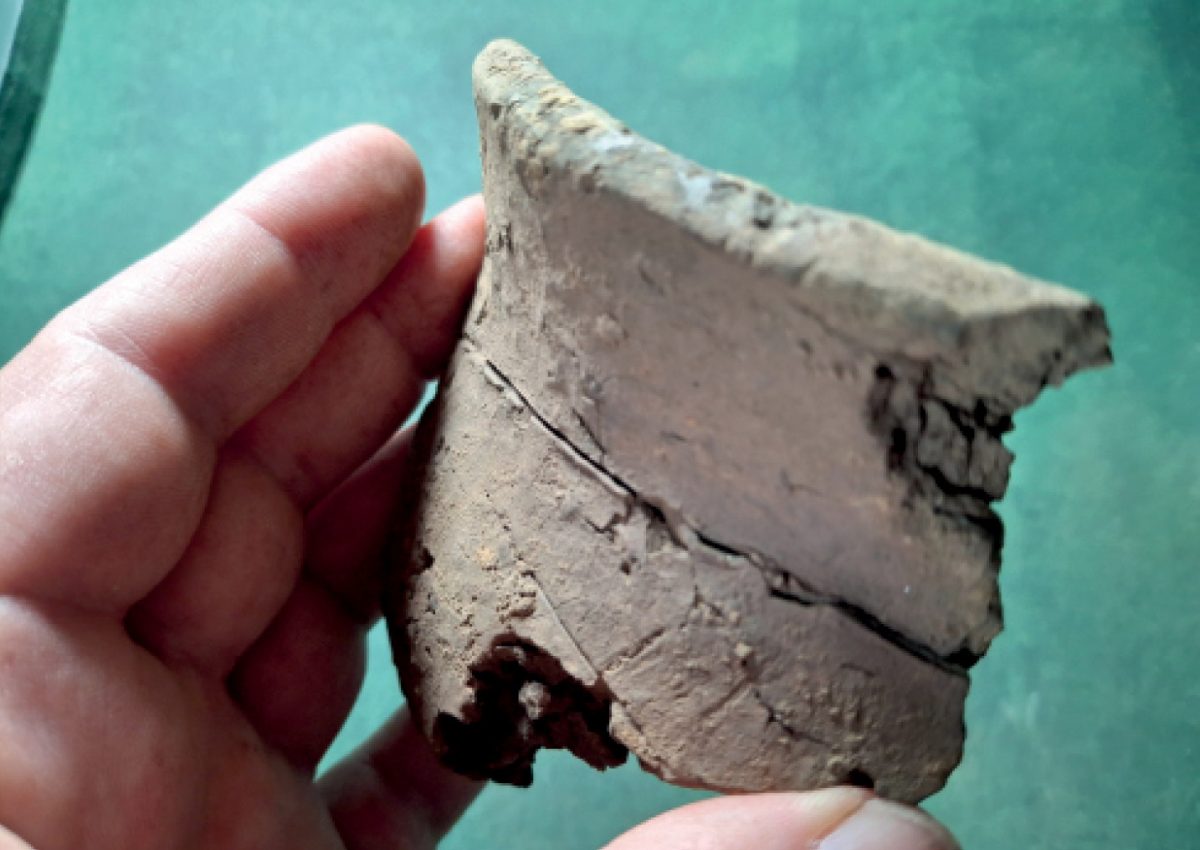
The most important archaeological discoveries on Staffa emerged unexpectedly. In 2016, excavation beside the Bothy revealed what initially appeared to be a charcoal- rich pit cut into natural clay. This feature produced burnt stone, flint artefacts, animal bone, charcoal, and pottery, including a decorated sherd belonging to a Hebridean prehistoric ceramic tradition. At first, the pit’s significance was not fully understood, but a breakthrough came when a carbonised seed recovered from its lowest fill was submitted for radiocarbon dating. The result, 1883-1701 cal BC, demonstrated that the pit belonged to the Early to Middle Bronze Age. Staffa had suddenly revealed the first clear evidence for prehistoric activity on the island. Armed with this date, we returned in 2018 and reopened the trench.
This second excavation demonstrated that the original pit actually formed part of a larger prehistoric monument. Beneath around 0.4m (1.3ft) of later soil and cultivation deposits lay a curving ring-ditch cut into natural clay. Although only part of the feature was excavated, it appears to have formed a circular structure between 4m and 5m (13-16ft) in diameter, with an associated post-hole or pit. The ditch fills produced the richest prehistoric assemblages yet recovered from Staffa: almost 100 pottery sherds, many decorated with incised chevrons, diagonal patterns, and impressed designs, as well as more than 60 pieces of worked flint, including blades, flakes, and manufacturing waste. The assemblage also included hammerstones, bevelled pebbles, possible Skaill knives, fire-cracked stones, and other tools associated with prehistoric daily life.
The concentration of artefacts within the ditch suggests prolonged human activity, and perhaps deliberate deposition during the feature’s use and eventual infilling. Comparisons have been drawn with Bronze Age ring-ditch houses elsewhere in Argyll, particularly examples around Kilmartin Glen, although ceremonial or funerary interpretations cannot yet be excluded. Whatever its precise function, the discovery demonstrated beyond doubt that Staffa was not simply visited occasionally in prehistory. People were living, working, and altering the landscape here nearly 4,000 years ago.
Subsequent discoveries have reinforced this conclusion. Prehistoric pottery and worked flint have now been recovered from multiple excavations across the central part of the island. Artefacts were found beneath the Bothy itself, within cultivation soils, around Structure C, and within enclosure deposits, and by 2019 it was becoming increasingly clear that the Bronze Age activity was part of a broader cultural landscape rather than an isolated feature.
This picture remains incomplete, but the existing evidence points towards sustained prehistoric use of Staffa’s central plateau. The island’s fertile soils, source of fresh water, and strategic location within the Inner Hebrides may all have contributed to its attraction. Moreover, the dramatic basalt cliffs that astonish modern visitors would have been equally striking in prehistory. It is difficult not to wonder whether the cave, columns, and powerful Atlantic setting possessed symbolic significance long before they became objects of Romantic admiration.

An island shaped by people
Staffa will always be celebrated for its geology. The cave, the columns, and the Atlantic setting ensure that. Yet archaeology has revealed a parallel story written not in basalt, but in the traces people left behind.
Bronze Age communities dug ring-ditches and used finely decorated pottery. Farmers cultivated oats and tended stock in the centuries before tourism. Nineteenth-century entrepreneurs constructed visitor shelters and stairways. Early tourists carved their names into the rock. Twentieth-century builders and engineers constructed jetties, walkways, and access routes. Modern archaeologists have begun piecing the evidence together.
Far from being solely a geological curiosity, Staffa has long been a lived and experienced landscape. The archaeological signatures now emerging from beneath its turf reveal a place where nature and culture have been intertwined for millennia. And for an island already famous throughout the world, that may be the most surprising discovery of all.
As with many archaeology projects, we set out to examine one thing and ended up with more information about another. We started by examining the archaeology of tourists, people who left their names inscribed into the basalt rock, and ended up with traces of people who lived and farmed on the island, who left their marks incised and stamped into highly decorated Bronze Age pottery. Could the geometric designs have been inspired by the volcanic landscape of columnar basalt in which they lived? (We need to find some hexagonal patterns!) This story will only continue to evolve, though, as the team, along with colleagues at the University of Southampton, will return to Staffa in the spring to carry out a further phase of exploration (funded by the AHRC RICHeS project), including geophysical survey and high-tech coastal survey. Watch this space.
We would like to acknowledge the support of funders for this work, including the National Trust for Scotland’s London Members’ Centre, the Society of Antiquaries of Scotland, and the AHRC RiCHeS Coastal and Inland Waters Heritage Science Facility.
• D B MacCullach (1975) Staffa (4th edn; David & Charles Inc).
• C Emett (1990) William Mounsey and the ‘Jew’ Stone (Castleberg, Giggleswick, UK).
• Victor Portela, Stuart Jeffrey, and Paul Chapman (2023) ‘Creating a VR experience of Fingal’s Cave, Isle of Staffa, Scotland’, in 3D Imaging of the Environment: Mapping and Monitoring (CRC Press; ISBN 9780367337933).
• Shona Noble (2019) ‘Fingal’s Cave: the integration of real-time auralisation and 3D models’, in VIEW: Journal of European Television History and Culture 7 (14): 5-23 (ISSN 2213-0969).
Source:
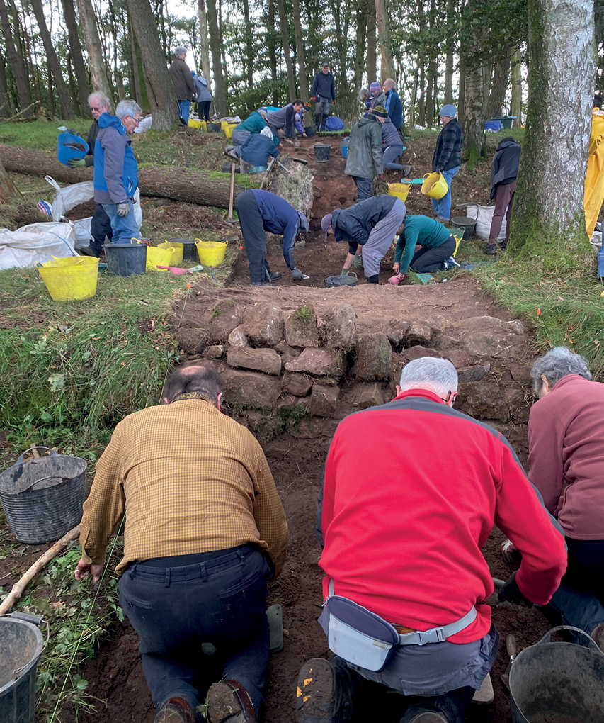
• Derek Alexander (2nd from left) and Dr Daniel Rhodes (far left) are National Trust for Scotland archaeologists.
• Professor Stuart Jeffrey (front, left) is Professor of Digital Heritage at the Glasgow School of Art.
• Professor Siân Jones (front, right) is Professor of Heritage at the University of Stirling.
• Dr Tessa Poller (back, far right) is Lecturer in Archaeology, University of Glasgow.

All images: Project partners