
Subscribe now for full access and no adverts
North of Lewes in East Sussex, the Upper Ouse Valley is home to an archaeological landscape rich with Roman remains, including evidence of industrial and agricultural activity, field systems, roads, and a winged corridor villa with a free-standing bathhouse. It was in order to investigate the wider historical environment around this last site (which was excavated by UCL and the Mid Sussex Field Archaeological Team in 2000-2007) that Rob Wallace founded the Culver Archaeological Project in 2005. Since then, under Rob’s direction and the supervision of qualified archaeologists, this volunteer community venture has been exploring the parishes of Barcombe and Ringmer, offering illuminating insights into the area’s Roman past. The support of the landowners, the Stroude family, has been vital for the project’s success: CAP simply could not exist without the kind permission of Harold (now deceased), Meg, and Mark to investigate on their farms, and we cannot give enough credit and appreciation for their inside knowledge of this landscape. So, with the project celebrating its 20th birthday this year, what have been some of its key discoveries?

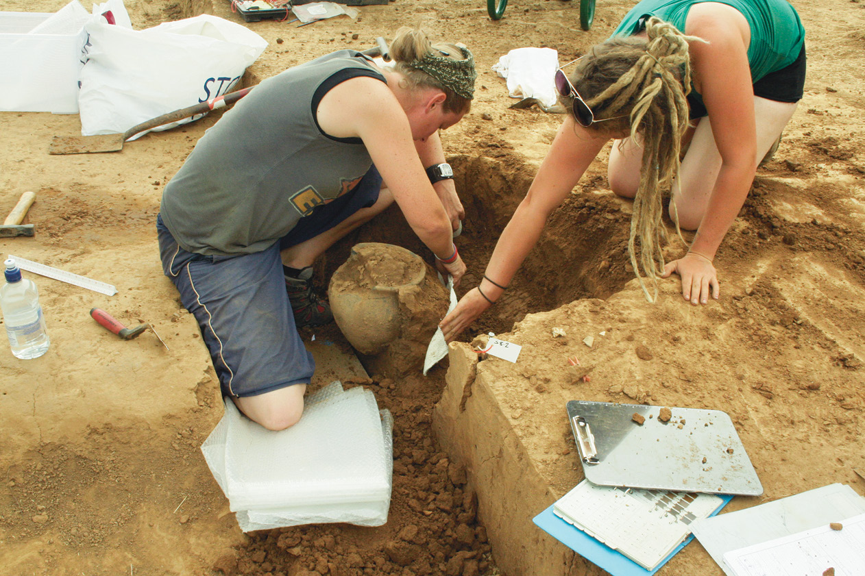
CAP’s story begins at Culver Farm, Barcombe, which was the focus of its first phase of work between 2005 and 2010. There, what was then only a small team carried out trial-trenching, geophysical surveys, and open-area excavation within several fields, revealing diverse Roman features – the most substantial and most significant of which was a previously unknown road running down the west bank of the River Ouse. Two sections of this route were initially investigated in neighbouring fields: one in Culver Mead (where, in 2006, the team also discovered three waterlogged timbers that were later radiocarbon dated to AD 240-430), and the other in Pond Field, to the south, where excavations ran from 2007 to 2010.
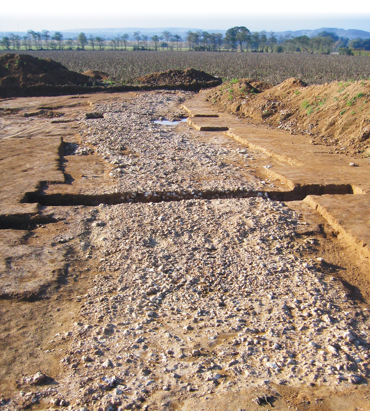
This work revealed that the road was made up of large flint nodules, with a cambered surface sloping down to ditches on each side, and the excavations uncovered evidence, too, of roadside industrial activity, indicated by pits, ditches, post-holes, and areas of burning. In Pond Field, though, the team found evidence of much earlier occupation as well: a Middle Bronze Age cremation, contained in a small, plain urn stylistically dated to c.1500-1000 BC. Three more possible cremations were identified nearby, lacking urns but represented by patches of charcoal and burned bone. Then, in 2009, the project’s focus shifted south once again, examining a continuation of the same road in Court House Field – although in this area we could see a clear kink in the route’s line, possibly deviating from its course due to the need to cross a palaeochannel. And there was still more to come: during this period, we were able to borrow both an earth-resistance meter and a magnetometer, which allowed us to trace the road even further, following it as it skirted east of the villa complex and headed south towards the Downs at Offham.
Road to the past
It was this interest in the area’s Roman infrastructure that led us across the river to Bridge Farm, on the eastern bank of the Ouse, in 2011. Our initial aim had been to carry out a geophysical survey to plot the course of the Roman road from London (RR14) that had been discovered by Ivan Margary in the early 1930s. As the work (carried out with local geophysicist David Staveley) progressed, however, it soon became clear that the fields at Bridge Farm contained a great deal more than just a Roman road. We could see the route’s flanking ditches very clearly in the digital image produced by the survey, but there were two much larger ditches slicing across their northbound course as well. What were they for? Several more days of magnetometry provided the answer, revealing the characteristic round-cornered square of Roman defensive earthworks, bounded by double ditches and surrounded by field boundaries, with a very busy interior. At the north-east corner, we could see the London Road entering the enclosure to join an interior route running east–west, while a smaller road was visible too, running south through the centre and continuing beyond the enclosure towards the River Ouse.
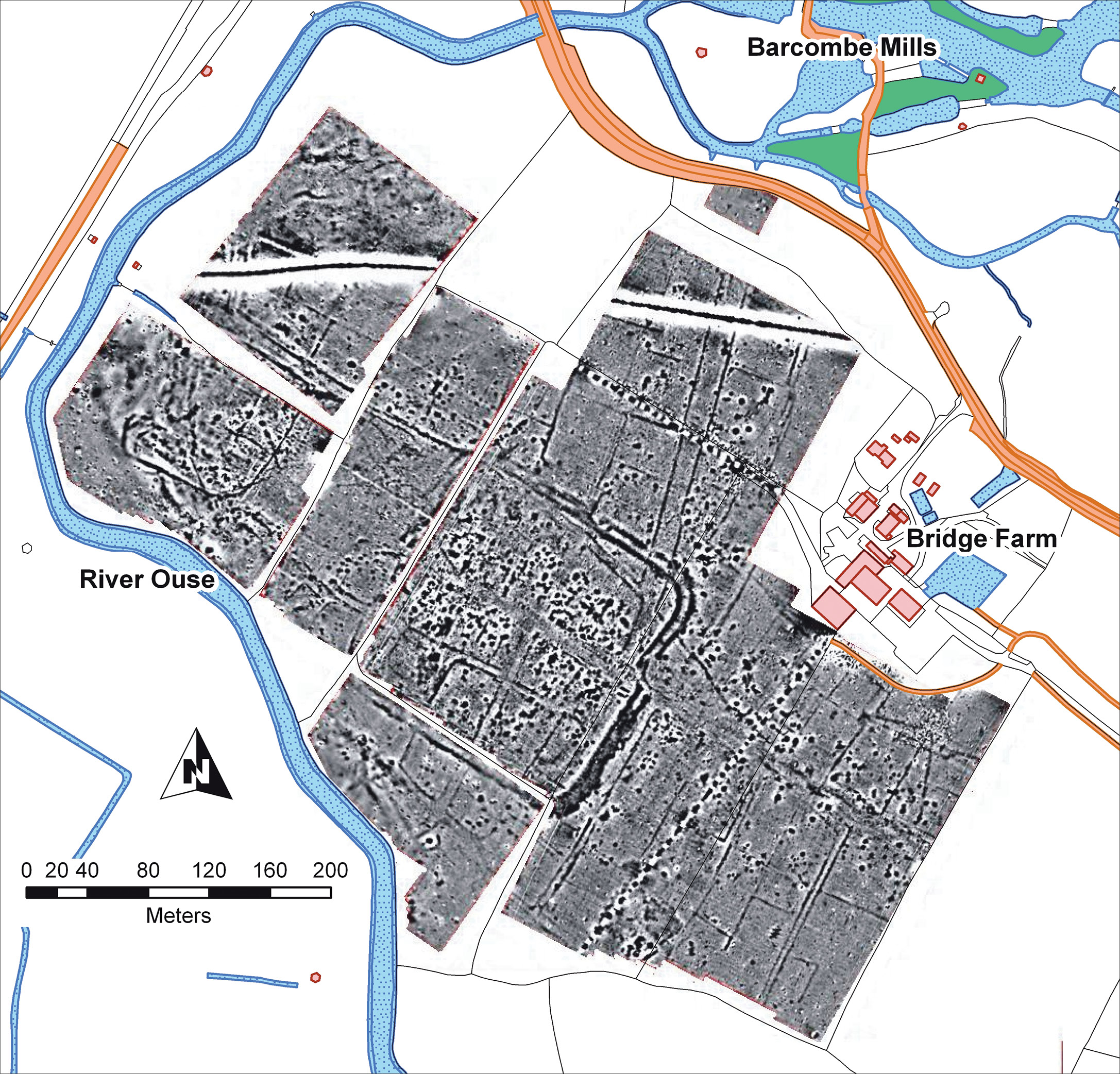
Systematic field-walking and metal-detecting surveys, organised by CAP in 2012, recovered artefacts that confirmed the Roman date of these features, and further geophysical surveys by David Staveley have been able to establish the course of more of the eastbound road. We can now trace its route through Ringmer to the Roman settlement at Arlington, and on to the Saxon Shore fort at Pevensey. Bridge Farm appears to have been an important junction on the east–west road from the regional capital at Noviomagus Reginorum (Chichester), linking it both with the London Road and a stretch of the River Ouse that was, at that time, navigable all the way to the coast. This network of connections would prove vital to interpreting what was already emerging as a rather unconventional settlement.
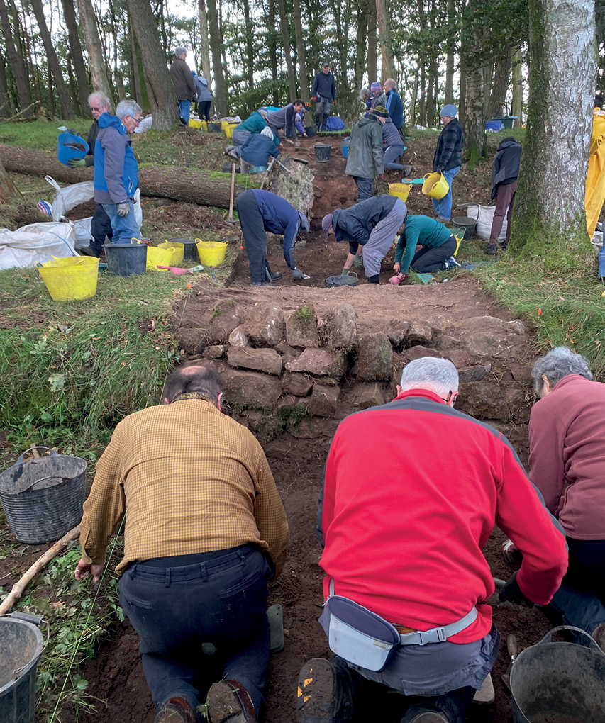
Our investigations gained a boost in 2013, when CAP secured a National Heritage Lottery Fund grant to carry out a one-year community excavation – support that allowed us to commission AOC Archaeology to assist in managing the large investigation, which was to be spread over four trenches. A key condition of the funding was to actively encourage members of the public and local schools to engage with their heritage, and happily there was no lack of willing participants. In our first season alone, 180 volunteers and 150 schoolchildren took part in the excavations, while over 400 people visited the site during the dig, and 500 attended talks by specialist archaeologists. This community aspect continues to be a key part of the project and is actively promoted every season, even as CAP expanded since those early days. We still encourage local people to discover the archaeology of the landscape in which they live, but CAP now also offers practical training to both volunteers and university undergraduates. The dig runs for six weeks every summer, and it includes a four-week course covering all the basics of archaeological fieldwork (see ‘Further information’ below).
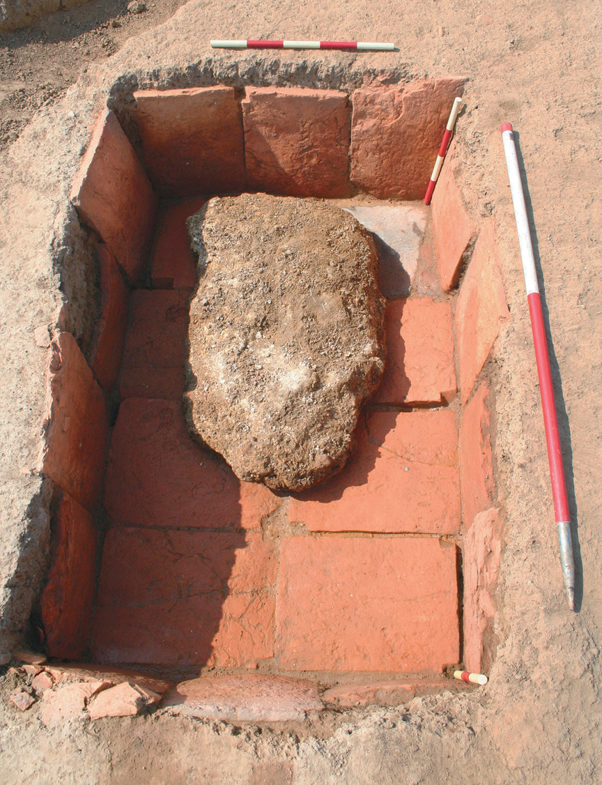
Returning to 2013, CAP’s first excavation at Bridge Farm concentrated on the southern enclosure ditches where they crossed the central road as it continued to the south towards the river. Trench 2 showed that the road was the earlier feature: its flanking ditches were cut by the larger ditches of the enclosure, and pottery analysis by the late Malcolm Lyne shed more light on this phasing, placing the roadside ditches in the second half of the 1st century, while the enclosure ditches date to c.AD 200. Nearby, Trench 3 revealed traces of a more commercial area – including a possible clamp kiln, a small four-posted building, and an intriguing rectangular pit lined with tegulae (roof tiles) and containing a lump of lime mortar – as well as a side road whose flint surface still preserved wheel ruts from the carts that had once passed along it. Trench 4 offered an additional surprise, in the form of another cremation – not prehistoric this time, but resoundingly Roman, dating to the 3rd century.

The following year saw CAP move to the west of the enclosure, opening Trench 5 in a meadow on the bank of the river to investigate the remains of a possible building. There, 13 large post-holes, each 1m in diameter, picked out the rectangular footprint of a structure measuring 16m by 6.4m. Remarkably, thanks to the waterlogged conditions of the soil, all 13 also contained the base of a c.0.4m-wide timber, testifying to the scale of this building, which has been interpreted as a possible warehouse dating to the late 3rd century. The preserved posts were a rare find for Sussex – but they were swiftly eclipsed when the removal of one of the bases revealed the presence of further prepared timbers which had been used as post-packing. Some of these pieces – which have since been conserved by Durham University – are uniquely carved, and timber expert Dr Damian Goodburn has suggested that they may have formed the ends of rafters from a long-vanished roof.
Digging deep
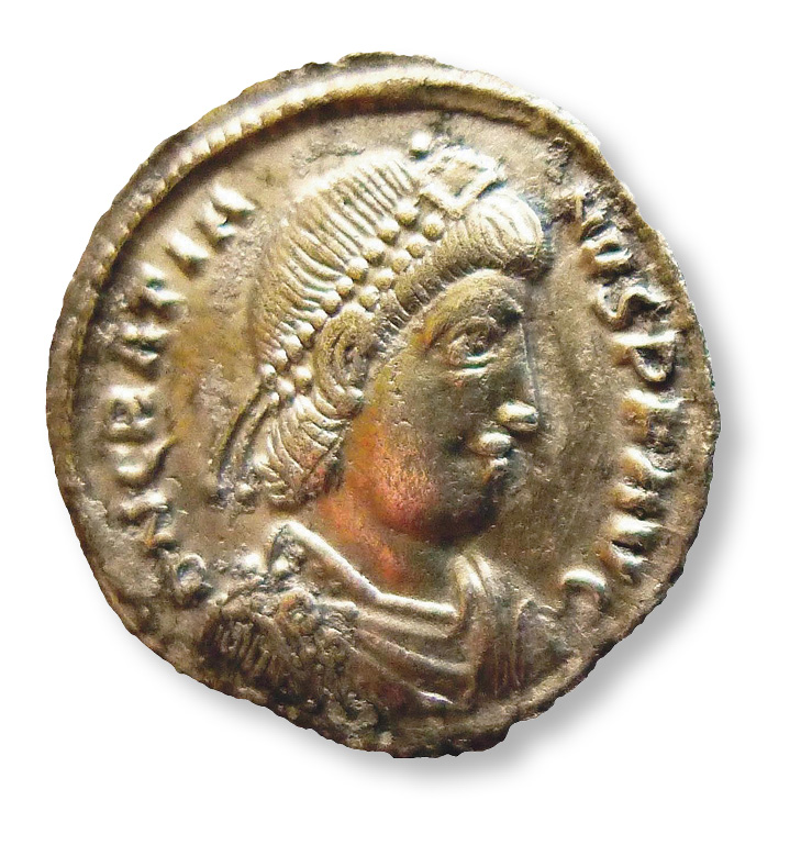
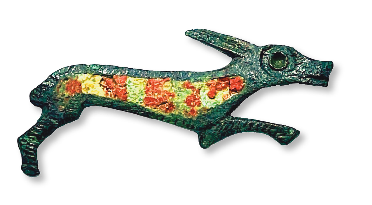
Within just two seasons, Trenches 1-5 had confirmed long-lived, multi-phased activity on the site, with artefacts spanning the mid-to-late 1st century through to the immediate post-Roman period in the early 5th century. Surface metal-detecting has been undertaken every year, increasing the variety of finds (especially coins) that have been found during the project. Three highlights for 2014 were a silver siliqua coin of Gratian (AD 375-383); a colourfully enamelled brooch, possibly depicting a long-eared leaping hound, which survives in stunning condition and has since been conserved at UCL; and a delicate scrap of silver, measuring just 9.4mm by 7.2mm, which preserves part of the Roman good luck message ‘VTER FELIX’. This text was recognised by Richard Hobbs at the British Museum, who was inspecting the find as part of the Treasure process; he suggests the fragment may come from a bezel for a 4th-century finger-ring.
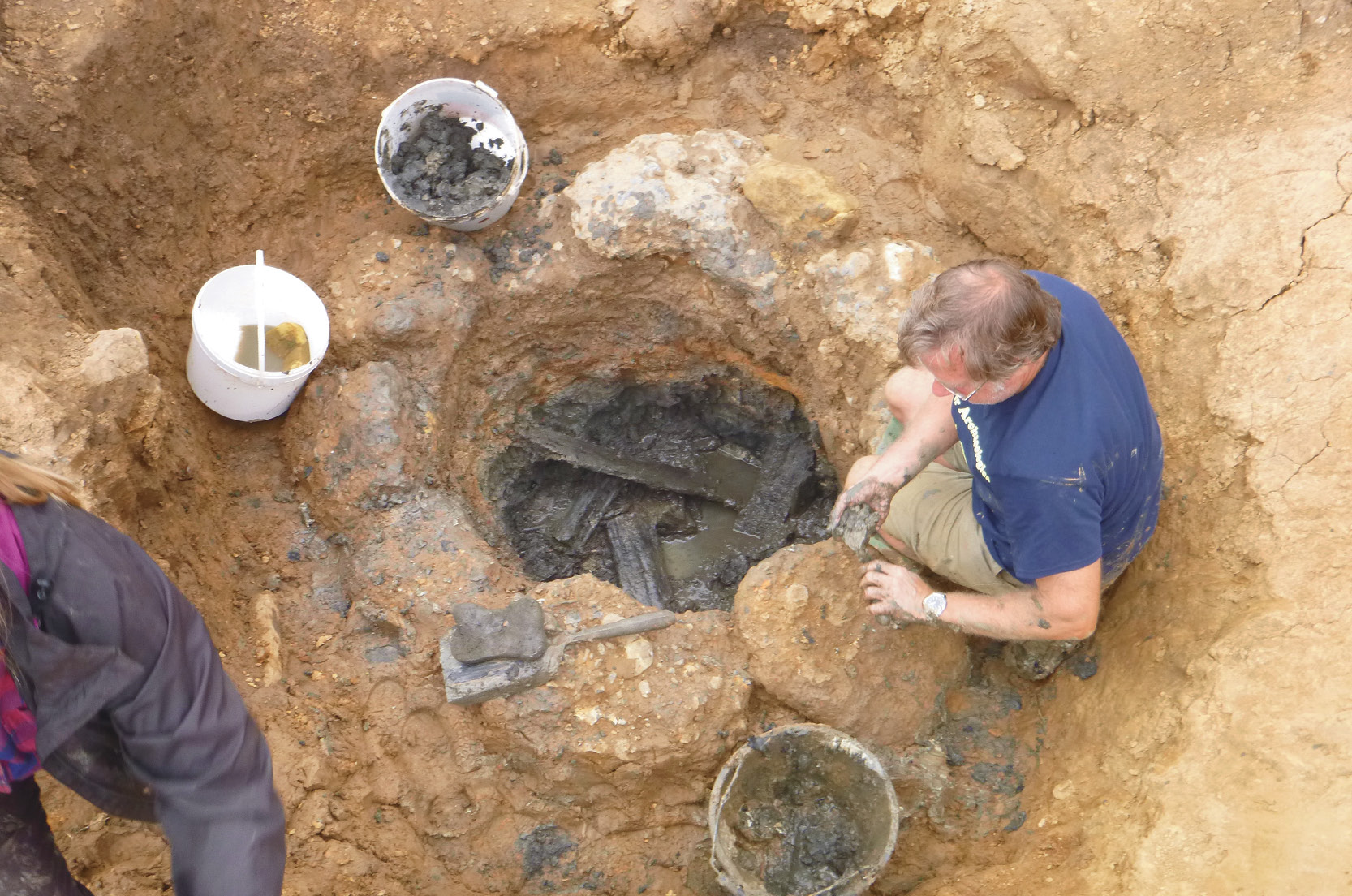
In 2015-2017, a new, 40m-square area of excavation (Trench 6) targeted the spot where the London Road crossed the enclosure ditches to the north-east. Its surface was found to overlie the enclosure ditches which, in this area, had been refilled in the late 2nd to early 3rd century – indicating that the flint- and-slag road surface that Ivan Margary had discovered some 80 years earlier dated to the 3rd to 4th century. We now believe that the original route of the London Road ran north from the centre of the settlement, although this is still to be tested by excavation. Trench 6 also revealed a range of pits, ditches, and post-holes to hint at the activities that had taken place in this area, but the undeniable star of the trench was a stone-lined well, probably dating to the 4th century, which still had timber framing surviving at its waterlogged base. The varying layers of stone that we identified provided crucial evidence of the well’s original structure, with chalk being used below the waterline and ironstone and flint conglomerate above.
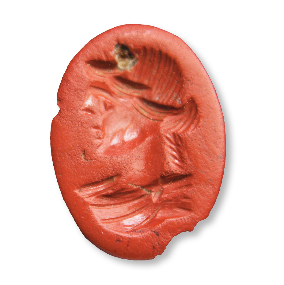
As well as larger features like those described above, Trench 6 proved to be especially rich in artefacts, particularly in a dark overlayer representing both activity and eventual decay during the 3rd to 5th centuries. Among these were 26,000 sherds of pottery, 175 Roman coins, and various items of jewellery including a red jasper intaglio decorated with a youthful profile that Reverend Professor Martin Henig suggests might represent the god Apollo. Finds like these highlight the importance of the specialist artefact assessments that are taking place as part of our post-excavation analysis, part-funded by generous grants from various trusts and societies. Since 2016, the project’s finances have also been greatly helped by an agreement with Canterbury Christ Church University for CAP to run a four-week field school, designed by Rob Wallace, to provide practical training for their undergraduate students – the origin of the course mentioned before, which is open to non-CCCU students and members of the general public too, and which has grown to become very well-regarded.
Defying expectations
CAP’s most recent phase, spanning 2018-2024, has focused on the centre of the enclosed area, where we opened our 45m by 20m Trench 7. It was thought that in this location, at the crossroads of the east–west and north–south roads through the settlement, there would be the greatest chance of discovering the remains of substantial buildings. However, once again Bridge Farm defied our expectations, instead providing a trench peppered with large, deep pits that were filled with high-temperature burnt deposits and rich in artefacts, especially pottery. Some of the pits were irregularly shaped, suggesting that their origins may lie in quarrying for materials or extracting tree roots, but many were well-dug with vertical sides and clear rectangular or ovoid plans. None gave clear evidence of their original purpose other than suggesting general industrial activities, including some iron-smelting and -forging. This emphasis was not unexpected, given that the London Road passes through the western area of iron production in the Weald (one of the key areas for this industry in Roman Britain) only a few kilometres to the north.
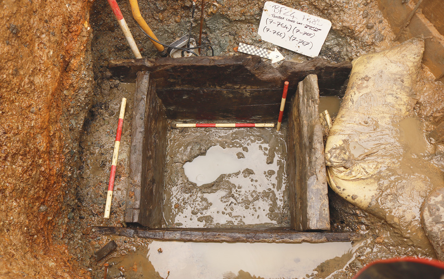
Trench 7 also revealed a second lined well, in this case containing a complete c.0.7m-square timber frame with two layers of boarding surviving to a depth of c.0.75m. Stratigraphy suggests that this structure was much earlier than the well in Trench 6, as it was truncated from above by a later Roman pit. Investigating its remains was no small task: in order to uncover the entire timber frame we had to take down a considerable amount of surrounding ground by hand, in 0.5m steps, while supporting the remaining sections of the upper pit with secured shuttering. Working within the constantly flooding, restricted space within the well cut was also challenging – but our efforts were more than worth it. While the upper timbers on the northern and western sides appeared to have been damaged by the later pit, the lower layer was more intact. The upper timbers, parts of two of the lower ones, and two exterior support timbers have since been safely removed for conservation, analysis, and potential dating, while the remaining lower timbers have been left in situ to be preserved by the waterlogged environment after careful backfilling.
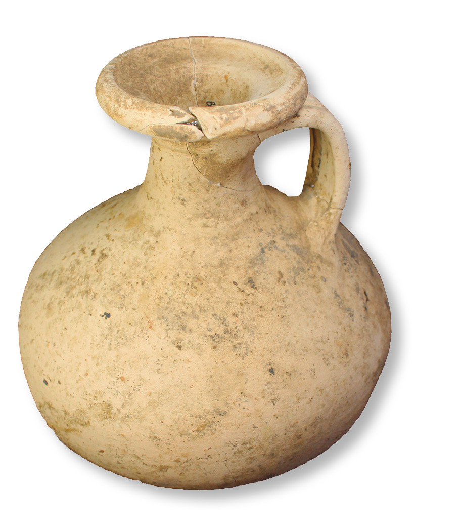
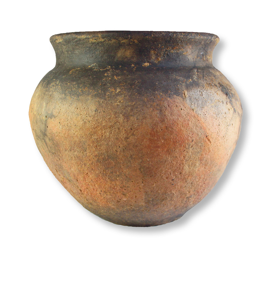
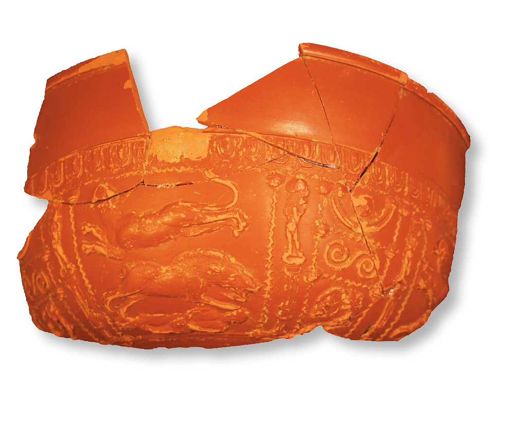
Top, above and below: Trench 7 has produced over 81,000 pottery finds, ranging from small fragments to entire vessels. Here we see an intact flask, a complete cooking pot, and an elaborately decorated piece of Samian ware.
The fill from within the well was either dry sorted and/or sieved, or collected in buckets for flotation if waterlogged – a process that recovered quantities of worked timber; leather including shoe fragments; a large, black colour-coated jug; two amphora sherds; cow, sheep, and dog bones; and a wooden knife-handle. Time constraints meant that flotation of the dozens of buckets could not be completed during the season, but they were safely stored by our Finds Unit, awaiting a concerted effort this spring.
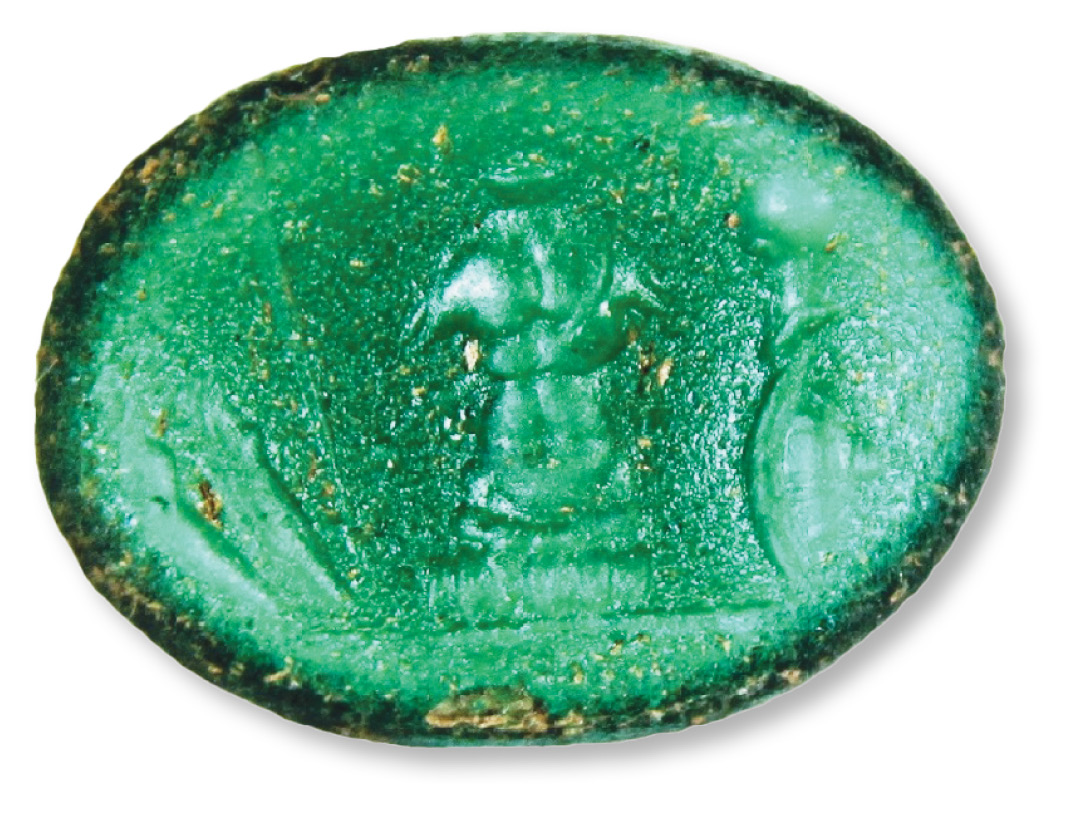
Other structures uncovered in this area include intriguing rows of post-holes, a square of holes representing a 5m-wide building, and the ditch that ran along the eastern side of the central, and potentially older, London Road. In terms of artefacts, Trench 7 has proved to be another finds-rich area. Of the more than 122,000 sherds of pottery collected on the whole site to-date, over 81,000 have come from Trench 7. They include an abundance of fine wares, among them decorated Samian (whose imagery includes depictions of Bacchus and Minerva; animals; humans, including a couple in an intimate embrace; and a complex composition with a big cat leaping over a boar, which is itself jumping over a supine man), colour-coated beakers, and a range of flasks, some of which have survived intact and encourage thoughts of weary workers and travellers relieving parched throats. Scatters of nails and hundreds of tesserae, meanwhile, could reflect the manufacture or storage of construction materials. As with other areas of the site, there was a variety of jewellery fragments, including brooches; beads; pins made of jet, bronze, and bone; and some ornaments with potential military connections. This last category includes a harness strap slide decorated with a horse’s head, and a green glass intaglio bearing an image of a corselet with a helmet and shield to the right, and a spear to the left – a composition that Martin Henig has interpreted as a ‘trophy of arms’ motif.
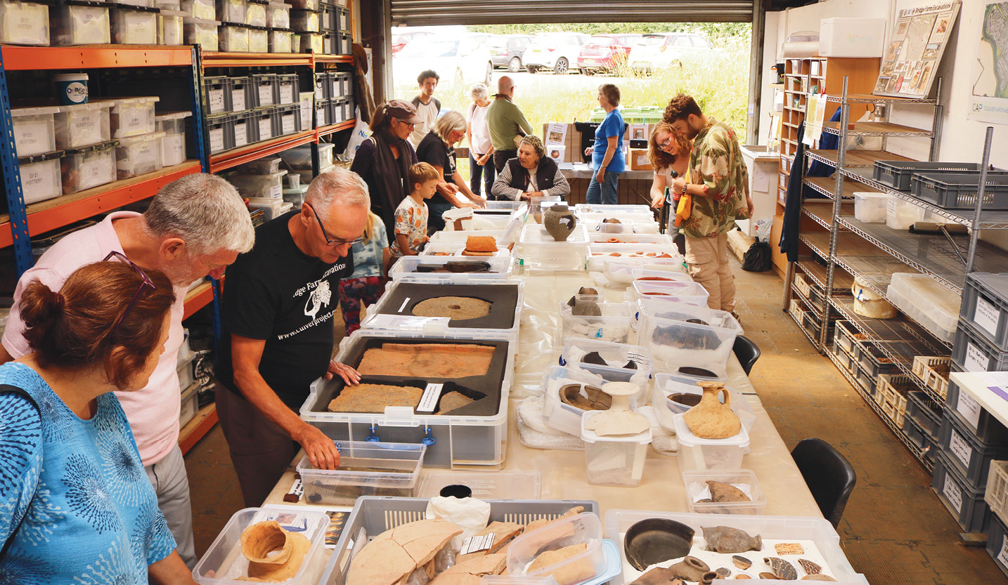
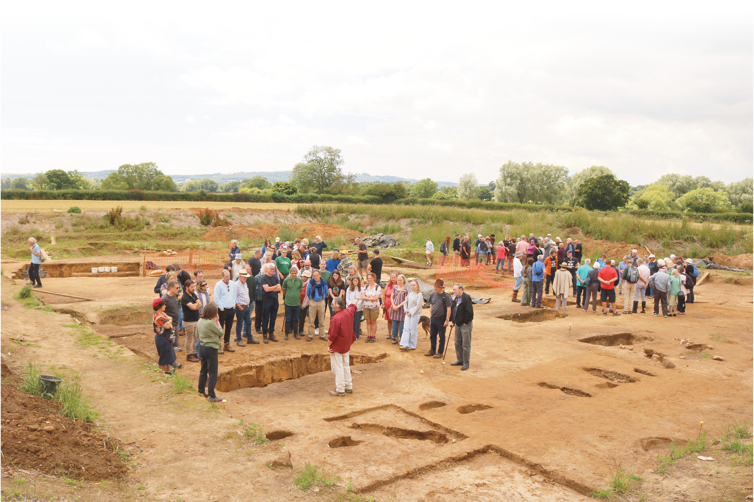
The quantity of artefacts produced each season certainly keep our Finds Unit busy, and allow for an impressive display at our annual open day, which always proves popular. Our 2024 event received over 400 visitors, necessitating multiple guided site tours, and we had a further opportunity to showcase our discoveries when CAP was approached by Worthing Museum, who went on to run a very successful exhibition about the site over the winter (CA 417).

Looking to the future
The archaeology at Bridge Farm is annually threatened by river floods and deep-rooted arable cropping in the sandy silt soil, but we are striving to document as much as we can of a type of Roman settlement that has, historically, been under-investigated. The site has not revealed any stone buildings, but there is evidence of post-built timber structures, roads, boundary- and defensive-ditches, and industrial activities during an occupation lasting over 300 years. The lack of substantial structures makes the large and varied artefact assemblages even more important for phasing the archaeology and for interpreting the main purpose of the settlement – and thereby the reason for its existence. Its location, linking the Roman road network with a navigable stretch of the River Ouse, strongly suggests an origin integral to transport infrastructure, while the wide range of artefacts suggests possible commercial activity with trade connections far and near. The settlement was also evidently of sufficient importance for the Roman authorities to sanction the construction of the surrounding earthwork defences in the late 2nd or early 3rd century. Might it have had an official role, perhaps linked to the wider distribution of Wealden iron and agricultural produce from surrounding estates?
This is an intriguing site that doesn’t give up its answers easily – which only adds to its being a firm favourite with the local archaeological volunteer community. The long-running Trench 7 has now been closed down, and this summer we will be opening a new Trench 8 just to the east of its predecessor, over the eastern entrance to the enclosed settlement. We are excited to see how the Bridge Farm story will develop further as our work continues – watch this space.
Further information:
The next phase of digging at Bridge Farm will run from 26 May until 4 July. Fuller details of the project, volunteering opportunities, excavation reports, and related published papers are available at http://www.culverproject.co.uk.
Source:
• Rob Wallace founded CAP in 2005 and has directed annual excavations to investigate the wider historic landscape of the Sussex Ouse valley.
• David Millum joined CAP in 2007, and was Deputy Director from 2011 to 2019. He now concentrates on the post-excavation work.
All images: Culver Archaeological Project