

Subscribe now for full access and no adverts
Radnorshire’s Cwmhir Abbey (meaning ‘the abbey of the long valley’) now consists of a fishpond and the walls of the abbey church, set in an ‘amphitheatre of hills of stupendous grandeur’ according to an early traveller in Wales. Suppressed in 1537, the abbey was plundered for its stone and five out of the 14 delicately carved 13th-century arcades ended up beautifying the church at Llanidloes, some ten miles distant.

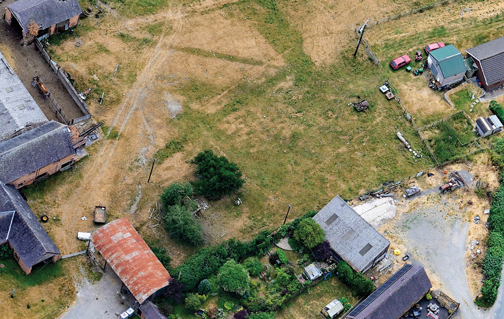
Drone photography taken by local archaeologist Julian Ravest has revealed a rich buried landscape of walls, ditches, field boundaries, and ridge and furrow in the fields surrounding the village, including the possible site of a post-Dissolution house built by William Fowler (who acquired the core of the abbey estate in the early 1560s) and defensive earthworks put up by the Royalist garrison during the Civil War. Aerial photographs taken by Toby Driver of the Welsh Royal Commission during the drought summer of 2018 revealed the existence of a probable monastic cemetery in the farmyard to the west of the abbey, which was excavated by Clwyd–Powys Archaeological Trust in 2019 (see Archaeologia Cambrensis 170: 151-157).
All this spurred the small village community (235 residents) to embark on an ambitious project to ‘Demystify the Abbey’. In 2021, the Trust ran a three-day geophysics field school to investigate two building platforms, a circular bank, and a possible Bronze Age cairn; a geology field school looking at local building stones and the sources of the abbey’s water supply; and an archaeobotany weekend to study the clues that plants can give about past landscape use. During July 2021, 30 local volunteers excavated the buried remains of a farmstead with possible medieval origins at Llanerchdirion.

Members are also using maps to match the boundary ditches and embankments surviving in the landscape to the landholdings mentioned in various abbey charters, the earliest of which dates from AD 1200. In some cases, the boundaries have remained little-changed since the late 1530s; on the other hand, the declining fortunes of the abbey are clear in the reduction from the 60 farms listed in a royal charter of 1318 to the 11 granges that were left under the management of the abbot and just three monks when the abbey was valued on the eve of the Dissolution.
Further information: https://abbeycwmhir.org
Is there a society that you would like to see profiled? Write to theeditor@archaeology.co.uk
IMAGES: Julian Ravest; Crown Copyright: Royal Commission on the Ancient and Historical Monuments of Wales: AP_2018_3439; Abbey Cwmhir Heritage Trust.


You must be logged in to post a comment.