


Subscribe now for full access and no adverts
During the last lockdown, coronavirus restrictions left many archaeologists locked out of their excavations, laboratories, and offices – and, even worse, cut off from one another. For around 100 volunteers, though, those six months proved an incredibly productive time. They were part of ‘Archaeology on Furlough’, an online programme that was set up to bring together archaeologists who were temporarily unable to work.
I created this initiative after realising that, although the government’s furlough scheme wouldn’t allow people to continue in their regular jobs, they were still free to volunteer and do training. So I set up a number of small group projects to help archaeologists work together on topics that had not been explored or were difficult to do in universities or commercial organisations. The goal was to provide archaeologists with support, but also to give them an opportunity to fill in some of the gaps in our knowledge and try out skills they didn’t get to use in their day jobs. The take-up exceeded my expectations: initially I had hoped for 20 or 30 volunteers, but within two days of launching the programme online more than 100 had registered. The next few weeks were frantic, as I expanded projects and added new ones for all these unexpected helpers – ultimately creating 13 teams working on ten projects.
The volunteers got together regularly via Zoom, kept in touch through chatrooms, and used online tools to research their topics and write reports. Archaeology on Furlough (AoF) was possible because of the huge amount of information that has been put online in the last decade. Tens of thousands of reports and articles are now available for free via the internet, along with literally millions of records in online databases like local Historic Environment Records (HERs) and the Portable Antiquities Scheme. So, even though the volunteers had to stay at home, they could still carry out research together.
What, then, did the volunteers find? After beginning in April, most of the teams are now winding up their reports, and they are already delivering fascinating new findings about Britain’s past, as well as creating resources for future research. Here are some of the highlights.
Aurochs in Britain

Thousands of years ago, a breed of wild cattle called aurochs roamed prehistoric Europe – including in Britain, where they became extinct c.1500 BC. Standing up to 180cm tall at the shoulder, with horns spanning more than a metre, they were much larger than modern domestic cattle. Until recently, research in Britain relied on a catalogue of 200 specimens compiled 20 years ago, supplemented by a few more-recent discoveries. One of our project teams set out to expand that dataset. They trawled online records, museum catalogues, and old journals to add more than 500 new sites where aurochs remains have been found – tripling the amount of information available for research.

The team has also recorded measurements from aurochs bones meaning that, combined with radiocarbon dating, it might be possible to identify changes in the size of the animals over time, potentially providing evidence for ecological pressure or competition with humans, and shedding light on the factors which led to their extinction. Moreover, after plotting all of the identified spots where aurochs bones have been found, the team noted some interesting patterns suggesting the types of landscape that these grazing animals favoured. There is a noticeable bias towards lowland areas, with fewer sites found on the uplands of Cornwall, Wales, Cumbria, or the Scottish Highlands. This may be partly to do with where there were more archaeologists and zoologists to recognise and identify the bones. But it also suggests that aurochs favoured landscapes where grassland could form easily, like river valleys and chalk downs, while avoiding thinner upland soils as well as dense woodland (such as the once-heavily forested Weald in Kent or the former Forest of Arden in the West Midlands).
Perhaps the biggest surprise of the project, though, was the discovery of aurochs crania excavated from two Roman sites and an Iron Age broch – all sites dated to well over a millennium after aurochs became extinct. Although they may have been chance finds, it is possible that the huge horned skulls had been handed down for hundreds of years.
Roman planting trenches
Moving from ancient animals to agriculture, over the last 30 years archaeologists across eastern and central England have excavated large fields of parallel trenches dating to the 1st and early 2nd centuries AD. These trenches are typically rectangular in profile, 60-80cm across, and would originally have been about the same depth. They rarely produced finds beyond occasional abraded pottery sherds and, oddly, they appear to have been backfilled almost as soon as they were excavated. What were they for? Traditionally such features are interpreted as remains of either vineyards or horticultural beds, but who had dug them and why was unclear.
To improve understanding, volunteers collected excavation records from eight counties and identified more than 50 examples – twice the number previously known. With this expanded dataset, the team analysed every aspect of the trenches. They found the botanical evidence was inconclusive: there were occasional charred grains indicating field manuring, and a few samples containing pollen from cereals and members of the Brassica family (turnips, cabbages, and wild varieties). Just one site produced evidence for grape cultivation, which suggested that the trenches were not generally used for vineyards.

When the volunteers researched what Roman writers had to say about potential crops and cultivation methods, they uncovered similarities between ‘planting trenches’ and descriptions of domestic gardens. But most of the trenches identified in Britain were substantially larger than the gardens described by Roman authors, capable of supplying hundreds of people. Strangely, though, most planting trenches were not located close to either villas or towns, where they might have fed such large populations. They were, however, closely associated with roads: indeed, more than half lay within 1km of a known Roman road. One possible interpretation is that the bulk of the planting trenches were established to support the army during the first century of Roman occupation, and were positioned close to roads in order to provision troops on manoeuvres. In that scenario, once civilian administration became established in the south and east of Britain in the 2nd century BC, and the military moved north and west, most of the planting trenches would have fallen out of use.
Volunteer profile:
I was really impressed with how enthusiastic all those I worked with were. It was easy to set up meetings because everyone was keen to be there and would routinely juggle their other commitments around in order to be available. During lockdown, AoF meetings would be the highlight of my week, something to be excited about during an otherwise quite depressing time. I was able to maintain and improve the skills I rely on at work, as well as meet a whole range of new, fascinating people. The success of AoF is a great representation of how passionate archaeologists are: we love what we do.
Robbie Luxford: Roman planting trenches
Grave matters
One of the most-popular projects in AoF was investigating human burials, with four teams collating data from Cambridgeshire and Oxfordshire, spanning the Late Iron Age, Roman, and early Anglo-Saxon periods. With more than 30 people contributing, over 4,000 burials were recorded in detail, producing a host of interesting insights. The teams gathered two main types of data: traumatic injuries on the skeletons and grave goods which accompanied the dead. Their datasets will help future researchers track many trends in Roman Britain over time, such as levels of violence, prosperity, and disparities in social status.

For example, in Cambridgeshire, Roman burials with sarcophagi, coffins, and other expensive ‘grave furniture’ were mostly associated with towns, and were only occasionally found in surrounding rural areas, reflecting the social distinctions between urban and rural populations. But in Anglo-Saxon Cambridgeshire, the distinction between town and country burials disappeared. There was, however, considerable variety within individual cemeteries. For instance, in the Anglo-Saxon cemetery at Edix Hill, Barrington, the skeletons identified as female were buried with a wide range of objects – mostly dress ornaments like brooches, beads, and rings, but also pots, spindle-whorls, and coins. Typically, women were buried with five or six types of object, although some had just one or two.
The most extravagant by far, though, were two ‘bed burials’, where the women had been buried lying in a bed – and in one case, also under a burial mound. One of these apparently elite individuals was accompanied by 11 different categories of object, including a rare iron-bound bucket and a weaving batten made from a cut-down sword. This profusion of artefacts in Anglo-Saxon burials in Cambridgeshire is in contrast to nearby late Roman burials from only two or three hundred years before, which were rarely accompanied by more than a single drinking vessel.
The large dataset will also help future researchers explore uncommon or unusual burial practices. For example, just over 1% of Anglo-Saxon burials recorded contained Roman coins, usually incorporated into strings of beads. Of Roman-era skeletons, 2% had been decapitated (one Roman man from Oxfordshire had even been buried with a pot where his head should have been). A few animal sacrifices were found, too: mostly small birds, but occasional haunches of meat and a few whole horses.

Among these finds there are echoes of moments when British society changed. Take an ostentatious cremation burial excavated in 1952 at Snailwell, Cambridgeshire. Dating to the years around the Claudian invasion of AD 43, this individual was buried in ways that showed Roman influences. Their cremated remains had been placed in a wooden litter or couch, surrounded by offerings including three amphorae and five wine jugs, pottery drinking vessels and platters from Gaul, two indigenous bowls, a bronze plate, a rare shield boss, a decorated bronze spiral armlet, decorated bone cheek-pieces from at least three horse bridles, and the bones of a piglet, a small fowl, and parts of a young cow. Of the 16 pottery vessels in the grave, just two were locally manufactured: the rest had come from across the Channel.

Anglo-Saxon architecture
Another Anglo-Saxon project explored their houses. Previously, much research on buildings of this period focused on southern Britain, but AoF volunteers sought out less-researched structures in the Midlands, northern England, and southern Scotland. They identified nearly 500 structures, then analysed about 250 in detail; these included domestic houses, halls, barns, and ‘sunken featured buildings’ (a type of structure built over a rectangular pit supported by a post at either end – it is not clear what these were used for).
Anglo-Saxon buildings are typically rectangular, often built to a standard layout twice as long as they were wide. The same form was used for domestic houses, workshops, and barns, and most buildings probably combined several functions. There was some variation along the length of Britain, however, and about a fifth of the northern buildings identified by the team did not fit within the types of building known in southern England. In fact, a very small number were even L-shaped and U-shaped.
Alongside generic rectangular buildings, the team also found some that had apparently been customised for particular uses. The largest of these were the halls. They were much larger than regular houses: up to 9m wide and, in some cases, over 35m long. Some halls excavated in the west of England were particularly massive, but also curiously isolated from other evidence for settlement. Because of their size and the care with which they were maintained, halls are generally interpreted as high-status structures capable of holding assemblies of people for such activities as feasting, political gatherings, tribute, and cult activities. Excavations often produce very little evidence for how halls were used, however: they appear to have been kept scrupulously clean, and those examined by AoF often appeared to lack hearths or internal wall dividers.
The team also found several other specialised buildings, such as a granary at Dunbar that had been set at some distance from the other domestic buildings on the site, and appeared to have different types of grain stored in separate areas within its walls. Meanwhile, among the smallest buildings identified by the volunteers were two tiny shielings or shepherd huts found in the uplands of Berwickshire, measuring only a few metres long.
Volunteer profile:
Archaeology on Furlough has been good for me in so many ways. At one level, it gave me focus during lockdown and the opportunity to do something worthwhile with the time. It provided me with the opportunity to apply the skills I had gained during my recent Master’s in landscape archaeology. As a result, with renewed confidence, I am now offering my research and GIS skills freelance. The big learning curve for me was working collaboratively, using Google Drive and Zoom to facilitate this. Working with like-minded people with the same passions has been so productive and very rewarding. I am buzzing with ideas to take the research further.
Heather Dawson: Anglo-Saxon houses

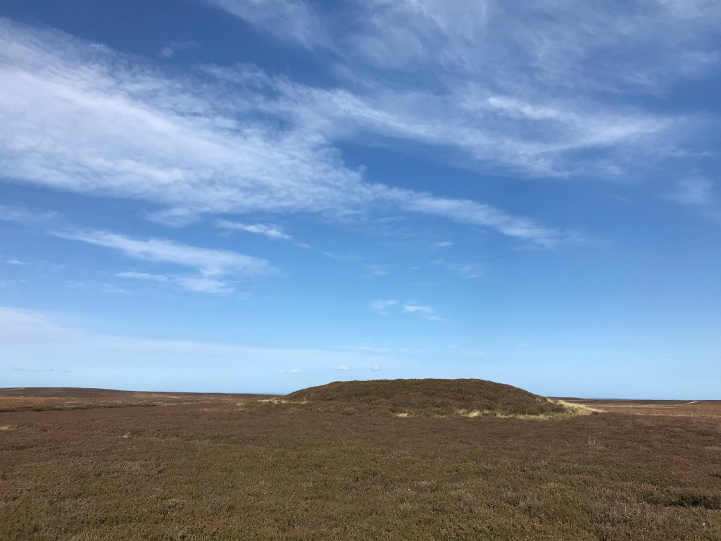
Mysterious mounds
Moving our focus to the south-west, we find Dartmoor, home to one of Europe’s largest Bronze Age landscapes, scattered with the remains of 3,000- to 4,000-year-old settlements, field systems, stone circles, and barrows. This remarkable preservation provides archaeologists with a laboratory to understand how Bronze Age people used this landscape, and one long-standing question has been about the significance of barrows. While most contain burials, it has long been suspected that some had additional functions. Some archaeologists have suggested that the mounds mark territorial boundaries or watch over important pastures and river crossings; others propose that they were sited to give the dead a view over their descendants or the wider landscape.
To explore different hypotheses, AoF volunteers experienced in Geographic Information Systems (GIS) analysed data provided by the Dartmoor National Park HER. They found several factors might have been important to Bronze Age builders. For example, when one of the volunteers plotted the most-efficient pathways between settlements – what is termed a ‘least cost path’ – in southern Dartmoor, they noticed that many barrows seemed to be positioned close by, as though the mounds marked the route or watched over travellers. The team also explored how visible barrows are – because Dartmoor is an upland area, with numerous hills and valleys, some parts of the landscape are visible from more places than others. Using Environment Agency LiDAR data, the team calculated the ‘total viewshed’ for one part of Dartmoor – and, intriguingly, when the locations of barrows were plotted, it was apparent that many had been erected in some of the most ‘invisible’ parts of the Dartmoor landscape.

Investigating henges
Henges are one of the most-enigmatic types of monument in Britain. These circular ditch-and-bank enclosures appear in the archaeological record around the same time as stone circles and timber circles in the Late Neolithic, and overlap with them on a few sites like Stonehenge and Avebury on Salisbury Plain, and the Ring of Brodgar in Orkney. But while around 1,300 stone circles are known in Britain, far fewer henges been identified – indeed, even a decade ago, most were only known from aerial photographs. Although several hundred potential sites have been catalogued, the number excavated before 2000 was limited. That situation has changed dramatically over the last two decades, though, and one group of AoF volunteers set out to gather information generated in excavations.

The project’s initial search focused on the main concentrations of henges in Scotland and the east of England, identifying 85 sites that have been wholly or partially excavated (the team is now expanding the search to cover the remainder of Britain). This found that henges are a highly varied form of monument: some of the excavated examples were less than 20m in diameter, while others exceeded 250m. Although examples with one, two, and four entrances have long been known, the team also found examples with three entrances or none at all. Moreover, over a quarter had circular structures inside, formed from arrangements of standing stones, timber posts, or pits. About a fifth of sites had avenues leading up to the entrance, and a few entrances were marked by standing stones. The team hopes that their final catalogue will help shed light on these Neolithic monuments.
Potted prehistory
Art and decoration in prehistoric Britain appears to be curiously limited in range. There are fewer than 20 realistic depictions of people, animals or objects, and the overwhelming bulk of artistic expression is in the form of geometric motifs, which is found on materials as varied as pottery, stone, metal, bone, and jet. However, even this decoration shows some curious omissions: while triangles, diamonds, and chevrons are common, squares and crosses are rare, and, outside rock art, circles and spirals are virtually unknown.
In some parts of the world, such as the south-west USA, archaeologists have shown that geometric decoration on pottery originated in basketry designs, with the entire sequence of development surviving in the archaeological record. These motifs were an inevitable by-product of weaving, which was then carried over to clay vessels. This transfer between baskets and pottery is the result of a cognitive process termed ‘mental simulation’, which psychologists have identified takes place when people plan and fashion objects. The development of decoration in Britain is more complicated, though – pottery did not develop here, but arrived c.4000 BC as a fully formed technology, a thousand years after it first appeared in north-west Europe (see CA 290). However, the project team’s research suggests that the same underlying cognitive functions might have been at work, and help explain geometric patterns in British pottery and other objects.

For example, the decoration on some British pots carries tell-tale hints of origins in basketry: rims on some pots appear to mimic the plaiting or binding on basket rims, while a few bases show radial patterns like the spokes in the bottom of round baskets. Other pottery styles show similarities with woven textiles, particularly in the early Bronze Age. Links to basketry would also explain why British decoration is limited to a few geometric motifs, and curved forms are almost entirely absent: circles and spirals are impossible to weave on the sides of baskets, but triangles and diamonds are comparatively easy. The process of mental simulation may explain the timing of transfers on to unrelated objects, too, such as from pottery to metalwork and stone, as well as their eventual decline in the Iron Age.
Volunteer profile:
Prehistoric art does not usually overlap with archaeology in the commercial sector, so I enjoyed the challenge of researching and writing about something outside my usual comfort zone. Though the initial lockdown was tough, through the project I felt a sense of personal achievement by staying mentally active and productive. The highlight for me, though, has been the journey of getting to know my team over Zoom. Our regular meetings were (and still are) something to look forward to, and I have no doubt we will remain good friends when our project draws to a close.
Phoebe Ronn: Dartmoor and burials

A second, entirely different, tradition appears in rock art. Most consists of ‘cup and ring’ decoration pecked into rocky outcrops, and, unlike the linear art on pottery and metal, the designs are mostly circular, with a small amount of Irish-influenced spirals and wavy lines found in a few western tombs. These circular motifs appear to be almost entirely restricted to rock art, and rarely spread to other media. The lack of transfer suggests that rock art had functions that made it inappropriate to transfer on to portable objects. While the purposes of British rock art remain obscure, suggestions include territorial boundaries or maps. These could potentially explain the lack of transference of the images to movable objects: it would be odd to put territorial claims on an object that could be easily destroyed or removed.

Lambing in the Lammermuirs
Sheep farming had profound effects on the economy, culture, and landscape of the Scottish Borders for centuries – as is reflected in the hundreds of enclosures that dot the region. One of our volunteer groups investigated this part of Scotland’s heritage by using aerial photographs, historic maps, and LiDAR data to catalogue 860 sheep-related sites in the Lammermuir Hills. These comprised 20 different types of enclosure, including simple circular sheepfolds, X- or Y-shaped ‘stells’, sheep washes, sheep houses, and a number of complex enclosures for managing stock. This is not the only way that sheep left their mark on the landscape, however: there are dozens of sheep-related placenames in the Hills – names like Rams Cleugh, Wether Law, and the Lammermuirs (‘lambing moors’) themselves. AoF analysed the various placenames across the hills, and found they were mix of Gaelic, Old English, and more-recent terms.
The Lammermuirs were not always used for grazing, though: there are remnants of rig-and-furrow ploughing visible in LiDAR images. The project team noticed that, wherever sheepfolds and ploughing were present in the same site, the structures were younger – they are material evidence of the displacement of farmers to make way for sheep pasture. A particularly unexpected development in their search of aerial photographs, however, was the identification of what is thought to be a previously unknown hillfort. Although it had been ploughed flat, the volunteers recognised the site’s significance at once – and while the hillfort’s precise location is currently being protected, the team hopes to investigate the discovery on the ground next year, working in partnership with the landowners, local council, and local community.

Sharing results
Contemporary archaeology is as much about generating and transforming information as it is about excavations and artefacts, and the final two AoF projects focused on how this is done by British archaeologists. The first team explored how commercial units can use digital tablets to record excavations. Although a few units have adopted onsite digital recording, most site records are still paper-based and must all be rekeyed into databases, taking time and creating opportunities for errors – particularly on large-scale excavations. Digital recording, by contrast, has the potential to cut costs and speed up processing, especially when linked to digital survey and specialists’ databases. Volunteers reviewed 35 digital tablets widely used in comparable work environments like construction, engineering, and mining to assess which might be suitable for archaeological work. They also outlined the types of databases, wireless technology, and IT support that archaeological units would need to make the best use of tablets.


The other team looked at how archaeologists use information. Archaeology on Furlough itself accidentally created a huge experiment in information access: more than 100 archaeologists searching online archives and databases for reports, articles, records, and data. The project team polled all the volunteers to ask them about their experiences of locating, acquiring, and using this information. The results highlight some particularly valued resources, such as the Archaeological Data Service and online journals, and the project’s conclusions suggest ways to improve the usefulness of published site reports and site archives.
Volunteer profile:
What I have enjoyed most about the project is that it’s shown us all how we can be active in archaeology without setting foot into an excavation. Being able to partake in an extensive report with other archaeologists from across the globe, using only online tools, has meant that there are likely many more projects which are yet to be discovered that can run in a similar format! Additionally, it’s another way that volunteers who aren’t in the heritage sector can get involved and contribute to it without excavation, bringing a closer connection between the public and archaeology.
Lauren O’Toole: Prehistoric art

As for our own reports, most of the teams have now finished their projects and the results are being released. While a few articles planned for archaeological journals may take some months to appear, the project reports and datasets are being progressively uploaded to the University of Cambridge’s Apollo repository, where they will be made available to the public for free – you can explore them at www.repository.cam.ac.uk.
Source
Rob Wiseman works with the Cambridge Archaeological Unit at the University of Cambridge. He specialises in prehistoric Britain.


