Subscribe now for full access and no adverts
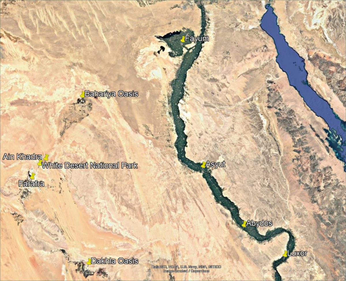
Farafra is a geological depression in the Western Desert of Egypt, lying between the Dakhla and Bahariya oases. Although today’s landscape appears dry and sparsely resourced, springs and wells have always provided essential locations for people and animals to rest and, in some cases, remain for longer periods.
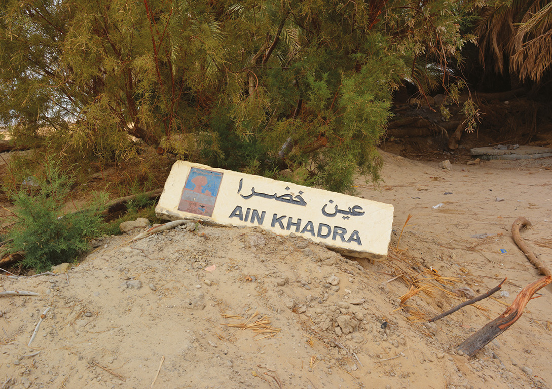
One such spring is Ain Khadra, which lies in the northern part of the Farafra Oasis. With its lush vegetation and crystal-clear waters, the spring provides welcome respite from the heat and dryness of the surrounding desert. However, the landscape surrounding this spring contains archaeological remains and other features suggesting that this was more than just a place to obtain water. The importance of these features lies not simply in what each one might have been, but in their relationship to one another, and what they reveal about human activity in the desert regions.
The observations presented here are based on field visits, photographic documentation, visible surface remains, and satellite imagery used to examine the wider spatial setting. No excavation, subsurface investigation or detailed analysis of the surface pottery has been undertaken. Some of the interpretations proposed below must therefore remain hypotheses for future investigation.
Desert routes
Farafra was part of a much wider desert environment through which people and animals moved between water sources, settlements, and stopping places. These desert routes linking Farafra with other oases, the Nile Valley, and the Saharan interior, changed over time and were not necessarily fixed tracks: they could branch or converge according to terrain, water availability, and local conditions. Ain Khadra therefore needs to be considered not only as an isolated spring, but as part of this wider desert landscape.
The Abu Ballas Trail provides a particularly useful comparison. Research there has identified sites associated with long-distance movement through the Libyan Desert, demonstrating how water, containers, structures, and traces of human activity could combine to support travel through an extremely arid environment. (For more on this trail, see Mahmoud Marai’s article in AE 155.) This does not establish a particular route through the site of Ain Khadra, but it does provide a useful comparative framework. Ain Khadra may therefore be considered a small spatial node within a wider landscape of water and movement.
The question then becomes not simply why people came to the spring, but how they organised and used the space around it.
A spring in the Western Desert
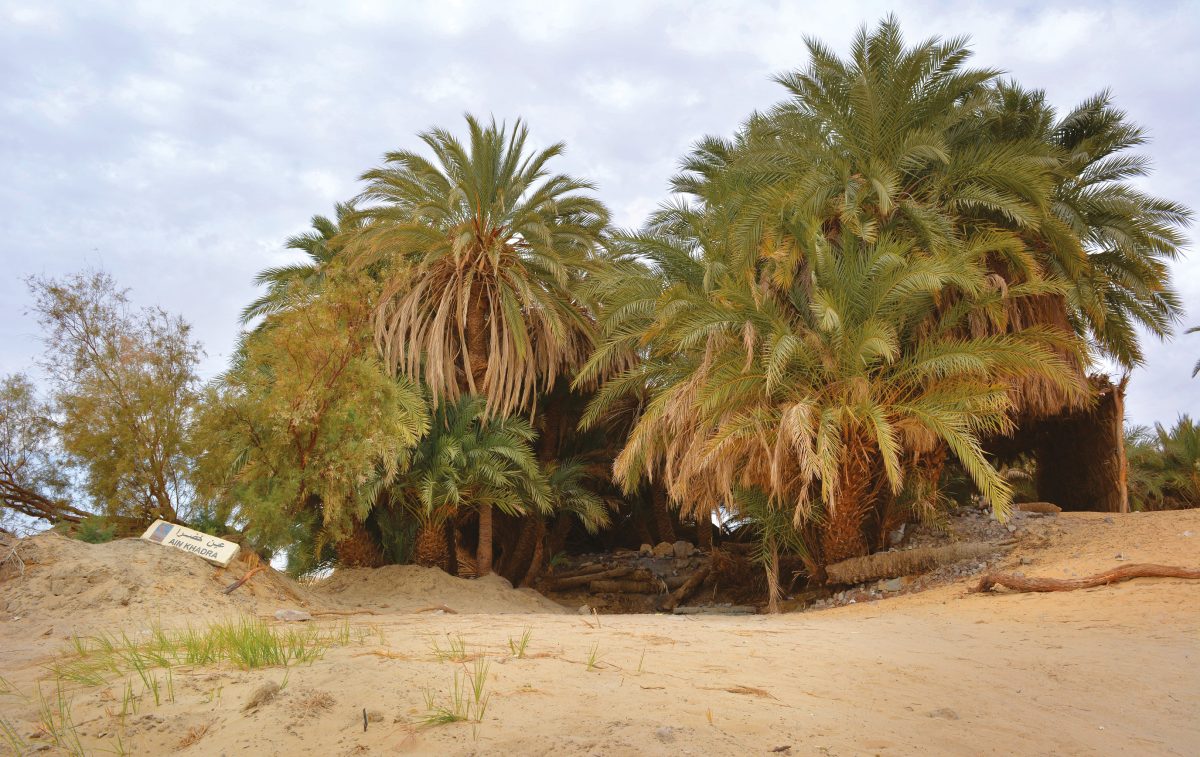
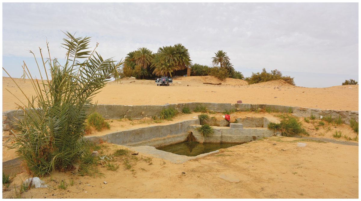
Ain Khadra lies on generally level ground with a limited number of low mounds and rocky rises. The spring emerges from a small mound and continues to flow today. Date palms and tarfa (tamarisk) grow around it, creating a conspicuous patch of vegetation within the surrounding desert. A modern installation currently collects some of the water, but this is not considered part of the archaeological remains discussed here.
Ain Khadra cannot be understood entirely in isolation from the other water sources in the surrounding area. These include:
• Ain al-Saru, south-east of Ain Khadra
• Ain al-Makfi, to the north-east
• Bir Rijiwa, south-west of Ain Khadra, near the main road
• Ain Dalla, further to the west
Their presence does not mean that all these sources were used during the same period, nor does their distribution allow a specific historical route to be reconstructed. They nevertheless illustrate a landscape in which water occurred at several points across the desert. Knowledge of such water sources would have been an essential part of movement through the region. Ain Khadra is therefore more meaningful when considered as one element within a wider network of water resources rather than as an isolated spring.
Archaeological remains
Ain Khadra is an archaeological landscape, in which the spring and surrounding remains can be viewed as parts of a single place shaped by water, movement, settlement, and the use of space. This does not mean that all the features belong to the same period or served the same purpose. Rather, considering them together provides a better way of understanding the character of the site and the questions it presents.
Rock-cut basin
South-east of the spring is a basin cut directly into the natural rock. It forms a relatively regular depression, with different levels and an opening through which excess water could drain. Sand now covers part of its floor. Its construction indicates deliberate human intervention in the management of water. It may have been used to collect, control, or drain water, although its precise function and date cannot be established from the available evidence. The basin is therefore important, not because it can be assigned to a particular period, but because it shows that people modified the natural water source to make better use of it.

The mound and building remains
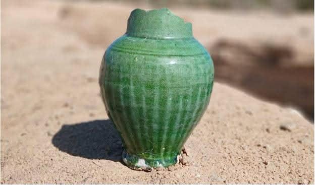
South-west of the spring is a mound containing the remains of earlier mud-brick buildings. Much of the surviving architecture is buried beneath sand, while parts of the mound have been disturbed by illicit digging. Pottery sherds of different shapes and sizes occur on the mound and around the spring. They confirm human activity, but have not been analysed typologically or chronologically as part of this study.
The buildings are particularly significant because they suggest that Ain Khadra was more than a place where people briefly collected water before continuing their journey. The site supported activities that required some form of built space. Whether these buildings were used for habitation, storage, or another purpose remains uncertain. Temporary or seasonal occupation is possible but cannot presently be demonstrated.
Their importance therefore lies less in assigning them a specific function, than in recognising that human use of Ain Khadra extended beyond the spring itself.
The linear stone structure
To the east and north-east of the spring is a roughly linear arrangement of local stones. Its continuity and relative regularity suggest deliberate construction, although sections have collapsed or become covered by sand. Its original height and purpose are unknown. The structure extends along the eastern and north-eastern side of the site, while a broad open space lies between it and the spring.
Several interpretations are possible. It may have helped organise movement, define a particular area, or separate one activity from another. A defensive function cannot be ruled out, but there is currently insufficient evidence to identify it as a defensive wall. For this reason, the neutral term ‘linear stone structure’ is preferable.
Al-Maqtala: place and local memory
Between the spring and the linear stone structure is a broad, level open space, locally known as Al-Maqtala. No clearly defined permanent structures are currently visible across this area. Its position nevertheless makes it an important part of the site’s organisation, lying directly between the water source and the linear stone structure.
According to local accounts, the Al-Maqtala may have been associated with earlier fighting, possibly over access to water. Such oral tradition should not, however, be treated as independent evidence that a battle actually took place here. The name is better understood as part of the site’s local memory – a reminder that landscapes can preserve stories as well as physical remains. Local knowledge can direct archaeological attention towards places that might otherwise appear unremarkable, but archaeological evidence is needed to establish whether the events remembered in such traditions actually occurred.


A rock-cut architectural feature
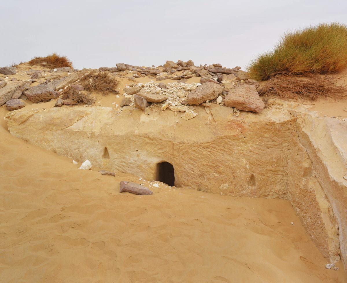
Near the basin is a small rock-cut feature resembling an entrance or chamber. Two recessed niches are visible, on either side of the opening. Their shape could suggest a practical use, perhaps for holding a light, but this cannot be demonstrated without more detailed architectural investigation. For now, the feature is best described simply as a rock-cut architectural element. Its presence adds another indication of human modification of the area around the spring.
The stone circles
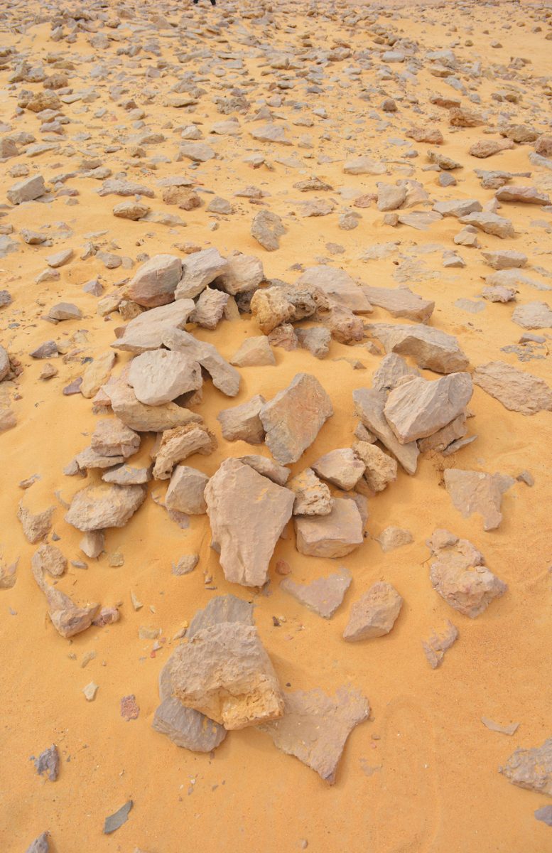
Several circular or roughly circular arrangements of small and medium-sized stones occur in parts of the site. They differ clearly from the linear stone structure on the eastern and north-eastern side. No obvious traces of burning or exposure to fire were observed, making an interpretation as hearths unconvincing on the evidence currently available.
Their original function remains uncertain. Some may have been associated with stopping places, or activities involving animals, perhaps including the temporary placement of fodder. These possibilities remain tentative and require further field investigation. The positioning of the stones within a water-centred landscape is nevertheless noteworthy. If future research demonstrates an association with animals or travellers, these small features could provide further evidence that Ain Khadra accommodated more than one type of activity.

Reading the landscape as a whole
The evidence does not allow a single, definitive interpretation of the site. It does, however, suggest several possible activities. Viewed together, the remains produce a more coherent picture than any individual feature can provide.
The spring was clearly the essential resource. The rock-cut basin shows that people modified the natural setting to manage water, while the building remains indicate activity extending beyond a brief visit to the spring. The linear stone structure remains the most enigmatic feature. It may have helped organise movement or space, or perhaps protected a particular activity or resource. Its precise purpose remains unknown. The stone circles may relate to animals or temporary stopping activities, although this too requires further investigation.
Al-Maqtala represents another dimension: the memory attached to the landscape. Its name and associated local tradition form part of the cultural history of the place, even though they cannot independently establish whether or not a historical event happened.
Ain Khadra can therefore be seen as a place where several activities may have intersected: water supply, stopping, human activity, possible animal-related practices, spatial organisation, and local memory. This arrangement does not prove that all the features were contemporary, or that they served fixed functions throughout the history of the site. It does suggest, however, that the use of the area was not entirely random. Water appears to have been the natural factor around which different forms of human activity developed.

A simple model of Ain Khadra
The landscape can be understood through six interconnected elements:
1. Water: the Ain Khadra spring, the central natural resource.
2. Water management: the rock-cut basin and the deliberate modification of the water source.
3. Human activity: the mound and building remains.
4. Animal-related activity: the stone circles, as a possibility requiring further investigation.
5. Spatial organisation: the linear stone structure and the open ground between it and the spring.
6. Local memory: Al-Maqtala and the traditions associated with the place.
These elements should not be understood as a chronological sequence or as evidence that everything was used simultaneously. They provide instead a framework for reading the landscape as it survives today.
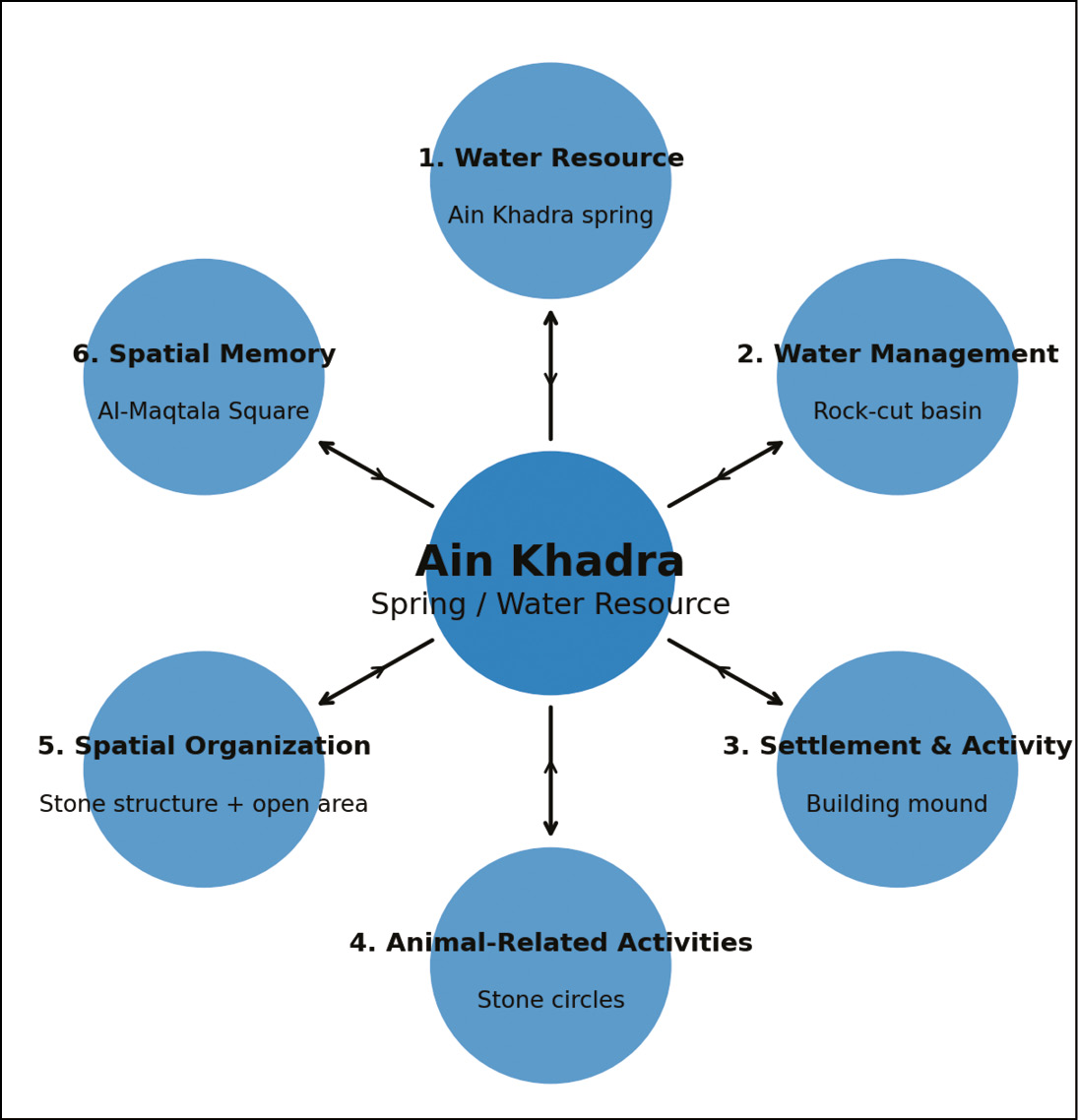
The evidence does not yet allow the date or precise function of every feature to be established. What can be said with greater confidence is that water was the fundamental factor that made Ain Khadra an important place for human use, and that the remains around the spring reflect different forms of activity and spatial organisation.
Future archaeological surveys, architectural recording, analysis of surface finds and, where appropriate, limited excavation could reveal more about the site’s history. For now, however, Ain Khadra demonstrates the value of looking beyond individual ruins. A spring, a basin, buildings, stones, and an open space may appear unrelated when viewed separately. Together, they tell a more compelling story: a small desert landscape shaped by water, used by people, and still carrying memories of the past.
Amir Ebrahim Elkorashy is Professor of History Education at Capital University, Egypt, with a PhD in History from Tanta University. He has published research on historical places, archaeological concepts, oral history, and heritage education, and has authored books on the Forty Days Road, the heritage of Minya, and the oases and desert palaces of Egypt.
• A Fakhry (1974) The Oases of Egypt: vol.2, Bahriyah and Farafra Oases (Cairo: American University in Cairo Press).
• F Förster (2007) ‘The Abu Ballas Trail: a pharaonic donkey-caravan route in the Libyan desert (SW-Egypt)’, in O Bubenzer et al. (eds) Atlas of Cultural and Environmental Change in Arid Africa (Cologne: Heinrich Barth-Institut), pp.130-133.
• C Vivian (2000) The Western Desert of Egypt: an explorer’s handbook (Cairo: American University in Cairo Press).
All images: the author, unless otherwise stated